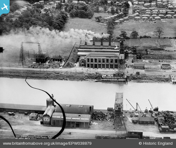
EPW038879 ENGLAND (1932). Preston Power Station on the River Ribble, Higher Penwortham, 1932. This image has been produced from a damaged negative.
    © Hawlfraint cyfranwyr OpenStreetMap a thrwyddedwyd gan yr OpenStreetMap Foundation. 2025. Trwyddedir y gartograffeg fel CC BY-SA.
  
Delweddau cyfagos (9)
Manylion
| Pennawd | [EPW038879] Preston Power Station on the River Ribble, Higher Penwortham, 1932. This image has been produced from a damaged negative. | 
| Cyfeirnod | EPW038879 | 
| Dyddiad | July-1932 | 
| Dolen | |
| Enw lle | HIGHER PENWORTHAM | 
| Plwyf | PENWORTHAM | 
| Ardal | |
| Gwlad | ENGLAND | 
| Dwyreiniad / Gogleddiad | 352190, 429209 | 
| Hydred / Lledred | -2.7252281197406, 53.756825833973 | 
| Cyfeirnod Grid Cenedlaethol | SD522292 | 
Pinnau
Byddwch y cyntaf i ychwanegu sylw at y ddelwedd hon!
 
             
  ![[EPW038879] Preston Power Station on the River Ribble, Higher Penwortham, 1932. This image has been produced from a damaged negative.](http://britainfromabove.org.uk/sites/all/libraries/aerofilms-images/public/100x100/EPW/038/EPW038879.jpg) 
  
                                          ![[EPW038874] Preston Power Station on the River Ribble, Higher Penwortham, 1932](http://britainfromabove.org.uk/sites/all/libraries/aerofilms-images/public/100x100/EPW/038/EPW038874.jpg) 
 ![[EPW038878] Preston Power Station on the River Ribble, Higher Penwortham, 1932. This image has been produced from a damaged negative.](http://britainfromabove.org.uk/sites/all/libraries/aerofilms-images/public/100x100/EPW/038/EPW038878.jpg) 
 ![[EPW038875] Preston Power Station on the River Ribble, Higher Penwortham, 1932](http://britainfromabove.org.uk/sites/all/libraries/aerofilms-images/public/100x100/EPW/038/EPW038875.jpg) 
 ![[EPW038876] Preston Power Station on the River Ribble, Higher Penwortham, 1932. This image has been produced from a damaged negative.](http://britainfromabove.org.uk/sites/all/libraries/aerofilms-images/public/100x100/EPW/038/EPW038876.jpg) 
 ![[EPW038877] Preston Power Station on the River Ribble, Higher Penwortham, 1932](http://britainfromabove.org.uk/sites/all/libraries/aerofilms-images/public/100x100/EPW/038/EPW038877.jpg) 
 ![[EPW007306] Albert Edward Dock and the River Ribble, Preston, from the south-east, 1921. This image has been produced from a copy-negative.](http://britainfromabove.org.uk/sites/all/libraries/aerofilms-images/public/100x100/EPW/007/EPW007306.jpg) 
 ![[EPW038884] Marsh Lane Road, New Diversion Quay and environs, Preston, 1932](http://britainfromabove.org.uk/sites/all/libraries/aerofilms-images/public/100x100/EPW/038/EPW038884.jpg) 
 ![[EPW055148] New Diversion Quay and the city, Preston, 1937. This image has been produced from a copy-negative.](http://britainfromabove.org.uk/sites/all/libraries/aerofilms-images/public/100x100/EPW/055/EPW055148.jpg)