
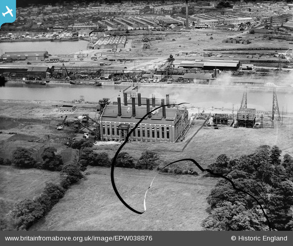
EPW038876 ENGLAND (1932). Preston Power Station on the River Ribble, Higher Penwortham, 1932. This image has been produced from a damaged negative.
© Hawlfraint cyfranwyr OpenStreetMap a thrwyddedwyd gan yr OpenStreetMap Foundation. 2026. Trwyddedir y gartograffeg fel CC BY-SA.
Delweddau cyfagos (7)
EPW038876

EPW038878

EPW038877

EPW038874

EPW038875

EPW038879

EPW007306

Manylion
| Pennawd | [EPW038876] Preston Power Station on the River Ribble, Higher Penwortham, 1932. This image has been produced from a damaged negative. |
| Cyfeirnod | EPW038876 |
| Dyddiad | July-1932 |
| Dolen | |
| Enw lle | HIGHER PENWORTHAM |
| Plwyf | PENWORTHAM |
| Ardal | |
| Gwlad | ENGLAND |
| Dwyreiniad / Gogleddiad | 352172, 429155 |
| Hydred / Lledred | -2.7254927721708, 53.756338810806 |
| Cyfeirnod Grid Cenedlaethol | SD522292 |
Pinnau

Dylan Moore |
Wednesday 5th of June 2019 09:51:46 AM |