
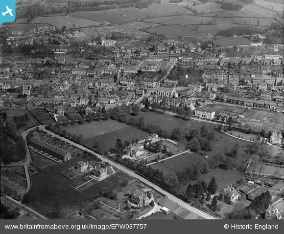
EPW037757 ENGLAND (1932). Trinity Road and the Stroud Hill area, Stroud, 1932
© Hawlfraint cyfranwyr OpenStreetMap a thrwyddedwyd gan yr OpenStreetMap Foundation. 2026. Trwyddedir y gartograffeg fel CC BY-SA.
Delweddau cyfagos (3)
EPW037757

EPW023882

EPW041863

Manylion
| Pennawd | [EPW037757] Trinity Road and the Stroud Hill area, Stroud, 1932 |
| Cyfeirnod | EPW037757 |
| Dyddiad | May-1932 |
| Dolen | |
| Enw lle | STROUD |
| Plwyf | STROUD |
| Ardal | |
| Gwlad | ENGLAND |
| Dwyreiniad / Gogleddiad | 385678, 204916 |
| Hydred / Lledred | -2.2074528774713, 51.742308230671 |
| Cyfeirnod Grid Cenedlaethol | SO857049 |
Pinnau

steiny |
Tuesday 29th of April 2025 04:17:32 PM | |
|
joepippmg |
Tuesday 25th of October 2022 04:29:55 AM | |
|
alice |
Monday 17th of January 2022 06:06:14 PM | |
|
amanda |
Wednesday 16th of August 2017 09:56:30 PM | |
|
amanda |
Wednesday 16th of August 2017 09:55:33 PM | |
|
amanda |
Wednesday 16th of August 2017 09:50:50 PM | |
|
angus |
Sunday 30th of June 2013 05:07:24 PM |