
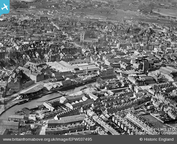
EPW037495 ENGLAND (1932). The Seven Bridges Brewery and Malthouses alongside the River Kennet, St Mary's Church and the town, Reading, 1932
© Hawlfraint cyfranwyr OpenStreetMap a thrwyddedwyd gan yr OpenStreetMap Foundation. 2026. Trwyddedir y gartograffeg fel CC BY-SA.
Delweddau cyfagos (18)
EPW037495

EPW037482

EPW037028

EPW037487

EPW037481

EPW037486

EPW037485

EPW037488

EPW037030

EPW037027

EPW037483

EPW037031

EPW037026

EPW037029

EPW037484

EPW037489

EPW022681

EPW022687

Manylion
| Pennawd | [EPW037495] The Seven Bridges Brewery and Malthouses alongside the River Kennet, St Mary's Church and the town, Reading, 1932 |
| Cyfeirnod | EPW037495 |
| Dyddiad | April-1932 |
| Dolen | |
| Enw lle | READING |
| Plwyf | |
| Ardal | |
| Gwlad | ENGLAND |
| Dwyreiniad / Gogleddiad | 471440, 173105 |
| Hydred / Lledred | -0.97176445150196, 51.451926933824 |
| Cyfeirnod Grid Cenedlaethol | SU714731 |
Pinnau
Byddwch y cyntaf i ychwanegu sylw at y ddelwedd hon!