
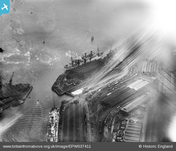
EPW037411 ENGLAND (1932). Ocean liners at the entrance to the Empress Dock and the Prince of Wales Dry Dock, Southampton, 1932. This image has been affected by flare.
© Hawlfraint cyfranwyr OpenStreetMap a thrwyddedwyd gan yr OpenStreetMap Foundation. 2026. Trwyddedir y gartograffeg fel CC BY-SA.
Delweddau cyfagos (11)
EPW037411

EAW033414

EPW039724

EPW037412

EAW033432

EPW041071

EPW009067

EAW001369
 in Ocean Dock, Southampton, 1946")
EPW009064

EPW009068

EAW001345

Manylion
| Pennawd | [EPW037411] Ocean liners at the entrance to the Empress Dock and the Prince of Wales Dry Dock, Southampton, 1932. This image has been affected by flare. |
| Cyfeirnod | EPW037411 |
| Dyddiad | April-1932 |
| Dolen | |
| Enw lle | SOUTHAMPTON |
| Plwyf | |
| Ardal | |
| Gwlad | ENGLAND |
| Dwyreiniad / Gogleddiad | 442744, 109898 |
| Hydred / Lledred | -1.3922689781192, 50.886432373268 |
| Cyfeirnod Grid Cenedlaethol | SU427099 |
Pinnau
Byddwch y cyntaf i ychwanegu sylw at y ddelwedd hon!