
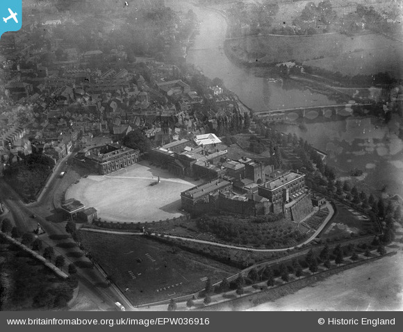
EPW036916 ENGLAND (1931). Chester Castle and Assize Courts, Chester, 1931
© Hawlfraint cyfranwyr OpenStreetMap a thrwyddedwyd gan yr OpenStreetMap Foundation. 2026. Trwyddedir y gartograffeg fel CC BY-SA.
Delweddau cyfagos (14)
EPW036916

EAW013775

EPW029882

EPW058005

EPW003087

EAW013773

EPW003092

EPW004001

EAW013774

EPW003088

EPW004002

EPW058008

EPW058012

EPW058003

Manylion
| Pennawd | [EPW036916] Chester Castle and Assize Courts, Chester, 1931 |
| Cyfeirnod | EPW036916 |
| Dyddiad | September-1931 |
| Dolen | |
| Enw lle | CHESTER |
| Plwyf | CHESTER CASTLE |
| Ardal | |
| Gwlad | ENGLAND |
| Dwyreiniad / Gogleddiad | 340499, 365782 |
| Hydred / Lledred | -2.8905313113635, 53.185514342907 |
| Cyfeirnod Grid Cenedlaethol | SJ405658 |
Pinnau
Byddwch y cyntaf i ychwanegu sylw at y ddelwedd hon!