
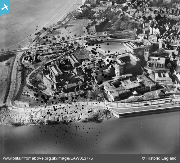
EAW013775 ENGLAND (1948). Chester Castle, County Hall and St Mary on the Hill Church, Chester, 1948. This image has been produced from a damaged negative.
© Hawlfraint cyfranwyr OpenStreetMap a thrwyddedwyd gan yr OpenStreetMap Foundation. 2026. Trwyddedir y gartograffeg fel CC BY-SA.
Delweddau cyfagos (15)
EAW013775

EPW036916

EPW029882

EPW058005

EPW003087

EPW003092

EAW013773

EPW004001

EAW013774

EPW004002

EPW003088

EPW058008

EPW058012

EPW058003

EPW058006

Manylion
| Pennawd | [EAW013775] Chester Castle, County Hall and St Mary on the Hill Church, Chester, 1948. This image has been produced from a damaged negative. |
| Cyfeirnod | EAW013775 |
| Dyddiad | 11-March-1948 |
| Dolen | |
| Enw lle | CHESTER |
| Plwyf | CHESTER CASTLE |
| Ardal | |
| Gwlad | ENGLAND |
| Dwyreiniad / Gogleddiad | 340495, 365752 |
| Hydred / Lledred | -2.8905855830662, 53.185244229961 |
| Cyfeirnod Grid Cenedlaethol | SJ405658 |


