
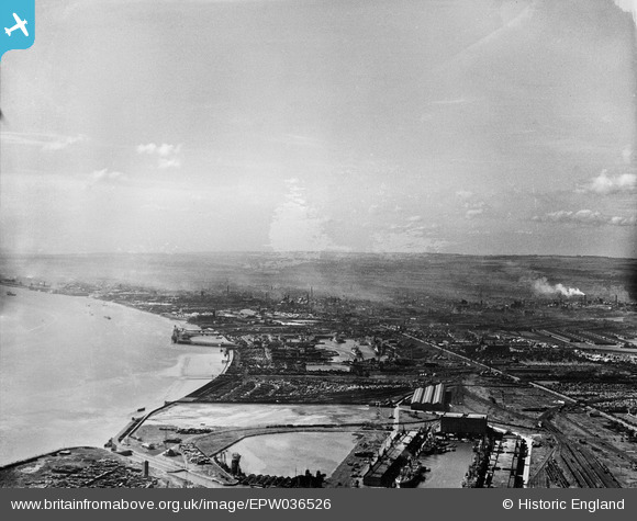
EPW036526 ENGLAND (1931). King George Dock and Alexandra Dock, Kingston upon Hull, from the east, 1931
© Hawlfraint cyfranwyr OpenStreetMap a thrwyddedwyd gan yr OpenStreetMap Foundation. 2026. Trwyddedir y gartograffeg fel CC BY-SA.
Delweddau cyfagos (3)
EPW036526

EPW036395

EPW012699

Manylion
| Pennawd | [EPW036526] King George Dock and Alexandra Dock, Kingston upon Hull, from the east, 1931 |
| Cyfeirnod | EPW036526 |
| Dyddiad | August-1931 |
| Dolen | |
| Enw lle | KINGSTON UPON HULL |
| Plwyf | |
| Ardal | |
| Gwlad | ENGLAND |
| Dwyreiniad / Gogleddiad | 512999, 428965 |
| Hydred / Lledred | -0.28635806856615, 53.744575611539 |
| Cyfeirnod Grid Cenedlaethol | TA130290 |
Pinnau
Byddwch y cyntaf i ychwanegu sylw at y ddelwedd hon!