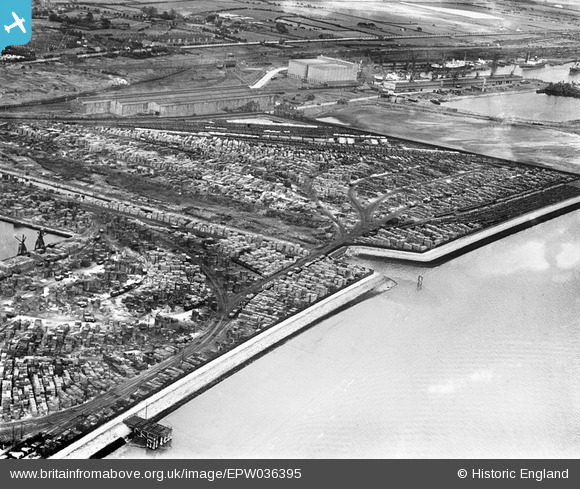
EPW036395 ENGLAND (1931). Timber Yard alongside Alexandra Dock and the King George Dock Grain Silo, Kingston upon Hull, 1931
© Hawlfraint cyfranwyr OpenStreetMap a thrwyddedwyd gan yr OpenStreetMap Foundation. 2026. Trwyddedir y gartograffeg fel CC BY-SA.
Manylion
| Pennawd | [EPW036395] Timber Yard alongside Alexandra Dock and the King George Dock Grain Silo, Kingston upon Hull, 1931 |
| Cyfeirnod | EPW036395 |
| Dyddiad | August-1931 |
| Dolen | |
| Enw lle | KINGSTON UPON HULL |
| Plwyf | |
| Ardal | |
| Gwlad | ENGLAND |
| Dwyreiniad / Gogleddiad | 513092, 428771 |
| Hydred / Lledred | -0.28501940558139, 53.742812341365 |
| Cyfeirnod Grid Cenedlaethol | TA131288 |
Pinnau

John Wass |
Monday 3rd of July 2017 03:44:07 PM |


![[EPW036395] Timber Yard alongside Alexandra Dock and the King George Dock Grain Silo, Kingston upon Hull, 1931](http://britainfromabove.org.uk/sites/all/libraries/aerofilms-images/public/100x100/EPW/036/EPW036395.jpg)
![[EPW036526] King George Dock and Alexandra Dock, Kingston upon Hull, from the east, 1931](http://britainfromabove.org.uk/sites/all/libraries/aerofilms-images/public/100x100/EPW/036/EPW036526.jpg)
![[EAW015640] The Alexandra and King George Docks and environs, Marfleet, 1948](http://britainfromabove.org.uk/sites/all/libraries/aerofilms-images/public/100x100/EAW/015/EAW015640.jpg)