
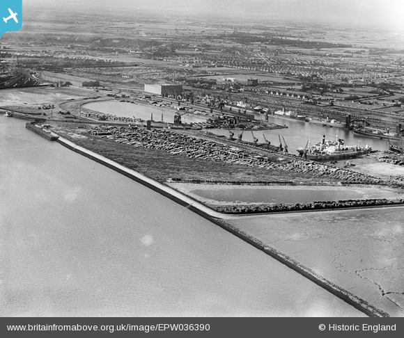
EPW036390 ENGLAND (1931). The King George Dock and environs, Kingston upon Hull, 1931
© Hawlfraint cyfranwyr OpenStreetMap a thrwyddedwyd gan yr OpenStreetMap Foundation. 2026. Trwyddedir y gartograffeg fel CC BY-SA.
Delweddau cyfagos (3)
EPW036390

EPW036383

EPW036511

Manylion
| Pennawd | [EPW036390] The King George Dock and environs, Kingston upon Hull, 1931 |
| Cyfeirnod | EPW036390 |
| Dyddiad | August-1931 |
| Dolen | |
| Enw lle | KINGSTON UPON HULL |
| Plwyf | |
| Ardal | |
| Gwlad | ENGLAND |
| Dwyreiniad / Gogleddiad | 514376, 428476 |
| Hydred / Lledred | -0.26566715446911, 53.739881653759 |
| Cyfeirnod Grid Cenedlaethol | TA144285 |
Pinnau
Byddwch y cyntaf i ychwanegu sylw at y ddelwedd hon!