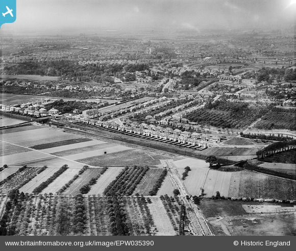
EPW035390 ENGLAND (1931). Housing at Whitton and environs, Whitton, from the south-east, 1931
    © Hawlfraint cyfranwyr OpenStreetMap a thrwyddedwyd gan yr OpenStreetMap Foundation. 2025. Trwyddedir y gartograffeg fel CC BY-SA.
  
Delweddau cyfagos (5)
Manylion
| Pennawd | [EPW035390] Housing at Whitton and environs, Whitton, from the south-east, 1931 | 
| Cyfeirnod | EPW035390 | 
| Dyddiad | 27-May-1931 | 
| Dolen | |
| Enw lle | WHITTON | 
| Plwyf | |
| Ardal | |
| Gwlad | ENGLAND | 
| Dwyreiniad / Gogleddiad | 514505, 173411 | 
| Hydred / Lledred | -0.35205487449698, 51.447605334555 | 
| Cyfeirnod Grid Cenedlaethol | TQ145734 | 
Pinnau
Byddwch y cyntaf i ychwanegu sylw at y ddelwedd hon!
 
             
  ![[EPW035390] Housing at Whitton and environs, Whitton, from the south-east, 1931](http://britainfromabove.org.uk/sites/all/libraries/aerofilms-images/public/100x100/EPW/035/EPW035390.jpg) 
  
                                          ![[EPW035380] Housing at Whitton and environs, Whitton, 1931](http://britainfromabove.org.uk/sites/all/libraries/aerofilms-images/public/100x100/EPW/035/EPW035380.jpg) 
 ![[EPW035386] Housing at Whitton and environs, Whitton, 1931](http://britainfromabove.org.uk/sites/all/libraries/aerofilms-images/public/100x100/EPW/035/EPW035386.jpg) 
 ![[EPW035391] Housing surrounding Redway Drive, Whitton Railway Station and Twickenham Rugby Football Ground in the distance, Whitton, 1931](http://britainfromabove.org.uk/sites/all/libraries/aerofilms-images/public/100x100/EPW/035/EPW035391.jpg) 
 ![[EPW035384] Housing at Whitton, Whitton Railway Station and Twickenham Rugby Football Ground in the distance, Whitton, 1931](http://britainfromabove.org.uk/sites/all/libraries/aerofilms-images/public/100x100/EPW/035/EPW035384.jpg)