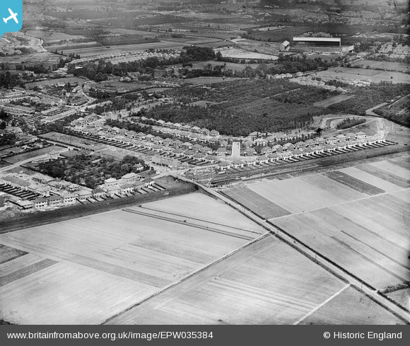
EPW035384 ENGLAND (1931). Housing at Whitton, Whitton Railway Station and Twickenham Rugby Football Ground in the distance, Whitton, 1931
    © Hawlfraint cyfranwyr OpenStreetMap a thrwyddedwyd gan yr OpenStreetMap Foundation. 2025. Trwyddedir y gartograffeg fel CC BY-SA.
  
Delweddau cyfagos (10)
Manylion
| Pennawd | [EPW035384] Housing at Whitton, Whitton Railway Station and Twickenham Rugby Football Ground in the distance, Whitton, 1931 | 
| Cyfeirnod | EPW035384 | 
| Dyddiad | 27-May-1931 | 
| Dolen | |
| Enw lle | WHITTON | 
| Plwyf | |
| Ardal | |
| Gwlad | ENGLAND | 
| Dwyreiniad / Gogleddiad | 514262, 173630 | 
| Hydred / Lledred | -0.35547982129033, 51.449622991878 | 
| Cyfeirnod Grid Cenedlaethol | TQ143736 | 
Pinnau
|  Twickenham rugby stadium |   jamspy | Wednesday 12th of November 2014 11:00:45 PM | 
|  Horse ploughing | Maurice | Saturday 25th of October 2014 06:16:48 AM | 
|  Whitton Station, Southern Railway. |   Isleworth1961 | Monday 11th of February 2013 03:42:54 PM | 
|  Kneller Hall |   Isleworth1961 | Monday 11th of February 2013 03:42:11 PM | 
 
             
  ![[EPW035384] Housing at Whitton, Whitton Railway Station and Twickenham Rugby Football Ground in the distance, Whitton, 1931](http://britainfromabove.org.uk/sites/all/libraries/aerofilms-images/public/100x100/EPW/035/EPW035384.jpg) 
  
                                          ![[EPW035391] Housing surrounding Redway Drive, Whitton Railway Station and Twickenham Rugby Football Ground in the distance, Whitton, 1931](http://britainfromabove.org.uk/sites/all/libraries/aerofilms-images/public/100x100/EPW/035/EPW035391.jpg) 
 ![[EPW035383] Housing at Whitton, Whitton Railway Station and Twickenham Rugby Football Ground in the distance, Whitton, 1931](http://britainfromabove.org.uk/sites/all/libraries/aerofilms-images/public/100x100/EPW/035/EPW035383.jpg) 
 ![[EPW035381] Housing at Whitton and Twickenham Rugby Football Ground in the distance, Whitton, from the south-west, 1931](http://britainfromabove.org.uk/sites/all/libraries/aerofilms-images/public/100x100/EPW/035/EPW035381.jpg) 
 ![[EPW035380] Housing at Whitton and environs, Whitton, 1931](http://britainfromabove.org.uk/sites/all/libraries/aerofilms-images/public/100x100/EPW/035/EPW035380.jpg) 
 ![[EPW035386] Housing at Whitton and environs, Whitton, 1931](http://britainfromabove.org.uk/sites/all/libraries/aerofilms-images/public/100x100/EPW/035/EPW035386.jpg) 
 ![[EPW035388] Housing at Whitton and environs, Whitton, 1931](http://britainfromabove.org.uk/sites/all/libraries/aerofilms-images/public/100x100/EPW/035/EPW035388.jpg) 
 ![[EPW035385] Housing at Whitton and environs, Whitton, from the south, 1931](http://britainfromabove.org.uk/sites/all/libraries/aerofilms-images/public/100x100/EPW/035/EPW035385.jpg) 
 ![[EPW035382] Housing along Prospect Crescent, Warren Road and Redway Drive, Whitton, 1931](http://britainfromabove.org.uk/sites/all/libraries/aerofilms-images/public/100x100/EPW/035/EPW035382.jpg) 
 ![[EPW035390] Housing at Whitton and environs, Whitton, from the south-east, 1931](http://britainfromabove.org.uk/sites/all/libraries/aerofilms-images/public/100x100/EPW/035/EPW035390.jpg)