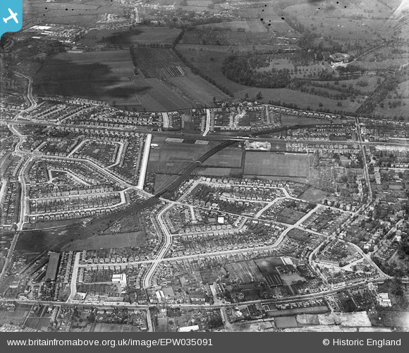
EPW035091 ENGLAND (1931). Thie District and Piccadilly Lines and surrounding residential development, Lampton, 1931
    © Hawlfraint cyfranwyr OpenStreetMap a thrwyddedwyd gan yr OpenStreetMap Foundation. 2025. Trwyddedir y gartograffeg fel CC BY-SA.
  
Delweddau cyfagos (5)
Manylion
| Pennawd | [EPW035091] Thie District and Piccadilly Lines and surrounding residential development, Lampton, 1931 | 
| Cyfeirnod | EPW035091 | 
| Dyddiad | May-1931 | 
| Dolen | |
| Enw lle | LAMPTON | 
| Plwyf | |
| Ardal | |
| Gwlad | ENGLAND | 
| Dwyreiniad / Gogleddiad | 514470, 176770 | 
| Hydred / Lledred | -0.3514705680331, 51.477805929233 | 
| Cyfeirnod Grid Cenedlaethol | TQ145768 | 
Pinnau
|  Milford Arms Public House |   glennsalt@gmail.com | Sunday 4th of September 2016 10:53:27 AM | 
|  Spring Grove Central School |   glennsalt@gmail.com | Sunday 4th of September 2016 10:51:39 AM | 
 
             
  ![[EPW035091] Thie District and Piccadilly Lines and surrounding residential development, Lampton, 1931](http://britainfromabove.org.uk/sites/all/libraries/aerofilms-images/public/100x100/EPW/035/EPW035091.jpg) 
  
                                          ![[EPW017384] The Great West Road and environs, Lampton, 1927](http://britainfromabove.org.uk/sites/all/libraries/aerofilms-images/public/100x100/EPW/017/EPW017384.jpg) 
 ![[EPW035075] Spring Grove Road and environs, Spring Grove, 1931](http://britainfromabove.org.uk/sites/all/libraries/aerofilms-images/public/100x100/EPW/035/EPW035075.jpg) 
 ![[EPW011660] The Great West Road, Spring Grove, 1924. This image has been produced from a damaged copy-negative.](http://britainfromabove.org.uk/sites/all/libraries/aerofilms-images/public/100x100/EPW/011/EPW011660.jpg) 
 ![[EPW056166] The London Transport Sports Ground, Osterley, 1937. This image has been produced from a print.](http://britainfromabove.org.uk/sites/all/libraries/aerofilms-images/public/100x100/EPW/056/EPW056166.jpg)