
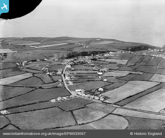
EPW033067 ENGLAND (1930). The village and surrounding counryside, Tintagel, from the south-east, 1930
© Hawlfraint cyfranwyr OpenStreetMap a thrwyddedwyd gan yr OpenStreetMap Foundation. 2026. Trwyddedir y gartograffeg fel CC BY-SA.
Delweddau cyfagos (5)
EPW033067

EPW033066

EAW020261

EPW033065

EAW020263

Manylion
| Pennawd | [EPW033067] The village and surrounding counryside, Tintagel, from the south-east, 1930 |
| Cyfeirnod | EPW033067 |
| Dyddiad | July-1930 |
| Dolen | |
| Enw lle | TINTAGEL |
| Plwyf | TINTAGEL |
| Ardal | |
| Gwlad | ENGLAND |
| Dwyreiniad / Gogleddiad | 205834, 88453 |
| Hydred / Lledred | -4.7476974786234, 50.662749720924 |
| Cyfeirnod Grid Cenedlaethol | SX058885 |
Pinnau

Andy Burton |
Tuesday 27th of May 2025 11:26:38 AM | |
|
Andy Burton |
Tuesday 27th of May 2025 11:26:32 AM | |
|
Andy Burton |
Tuesday 27th of May 2025 11:26:07 AM | |
|
Andy Burton |
Thursday 18th of January 2018 08:51:05 PM | |
|
piglittel |
Saturday 11th of May 2013 05:21:14 PM | |
|
piglittel |
Thursday 10th of January 2013 08:53:01 PM |