
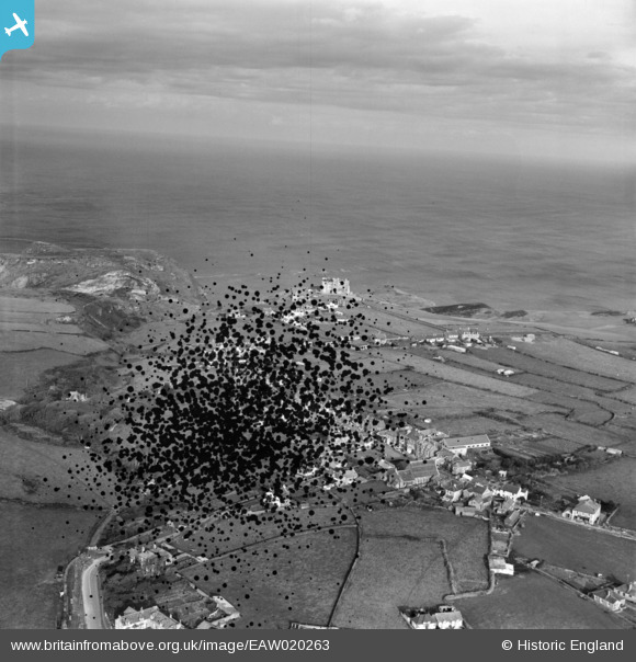
EAW020263 ENGLAND (1948). The village looking towards King Arthur's Castle Hotel and the sea, Tintagel, from the south-east, 1948. This image has been produced from a damaged negative.
© Hawlfraint cyfranwyr OpenStreetMap a thrwyddedwyd gan yr OpenStreetMap Foundation. 2026. Trwyddedir y gartograffeg fel CC BY-SA.
Delweddau cyfagos (6)
EAW020263

EAW020261

EPW033065

EPW033066

EPW033067

EPW033064

Manylion
| Pennawd | [EAW020263] The village looking towards King Arthur's Castle Hotel and the sea, Tintagel, from the south-east, 1948. This image has been produced from a damaged negative. |
| Cyfeirnod | EAW020263 |
| Dyddiad | 27-October-1948 |
| Dolen | |
| Enw lle | TINTAGEL |
| Plwyf | TINTAGEL |
| Ardal | |
| Gwlad | ENGLAND |
| Dwyreiniad / Gogleddiad | 205768, 88342 |
| Hydred / Lledred | -4.7485720642267, 50.661730546965 |
| Cyfeirnod Grid Cenedlaethol | SX058883 |
Pinnau

Andy Burton |
Thursday 23rd of July 2015 03:34:02 PM |