
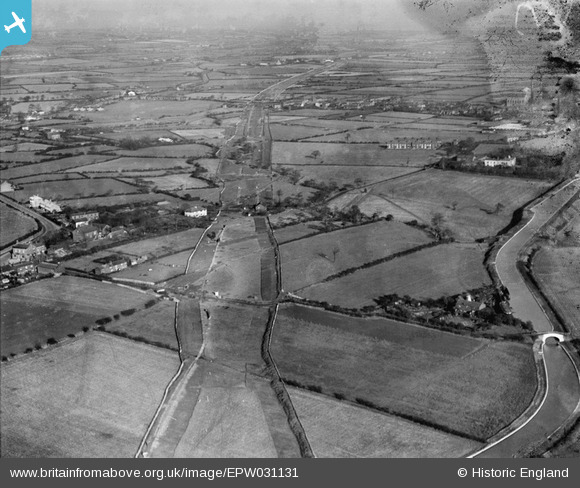
EPW031131 ENGLAND (1929). The A580 under construction, Town Lane, from the south-west, 1929
© Hawlfraint cyfranwyr OpenStreetMap a thrwyddedwyd gan yr OpenStreetMap Foundation. 2026. Trwyddedir y gartograffeg fel CC BY-SA.
Delweddau cyfagos (8)
EPW031131

EPW031135

EPW037208

EPW037207

EPW031132

EPW038569
 and Morley's Bridge under construction crossing the Bridgewater Canal, Town Lane, 1932. This image has been produced from a damaged negative.")
EPW037206

EPW037209

Manylion
| Pennawd | [EPW031131] The A580 under construction, Town Lane, from the south-west, 1929 |
| Cyfeirnod | EPW031131 |
| Dyddiad | October-1929 |
| Dolen | |
| Enw lle | TOWN LANE |
| Plwyf | |
| Ardal | |
| Gwlad | ENGLAND |
| Dwyreiniad / Gogleddiad | 369293, 399606 |
| Hydred / Lledred | -2.4628844574408, 53.492013871781 |
| Cyfeirnod Grid Cenedlaethol | SJ693996 |
Pinnau

SMJ |
Saturday 25th of May 2013 07:57:02 PM | |
On old-maps.co.uk these buildings are stated as a boat yard. Morleys Hall is on the Liverpool side of the bridge and is not on this picture. |
Dave |
Tuesday 29th of October 2013 08:25:13 PM |
On old-maps.co.uk these buildings are stated as a boat yard. Morleys Hall is on the Liverpool side of the bridge and is not on this picture. |
Dave |
Tuesday 29th of October 2013 08:25:15 PM |
|
SMJ |
Wednesday 5th of December 2012 02:57:18 PM | |
|
AD |
Friday 19th of October 2012 04:28:50 PM | |
|
AD |
Friday 19th of October 2012 04:28:22 PM |