
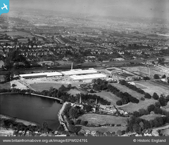
EPW024791 ENGLAND (1928). The Triplex Glass Works and environs, Kings Norton, from the south-west, 1928
© Hawlfraint cyfranwyr OpenStreetMap a thrwyddedwyd gan yr OpenStreetMap Foundation. 2026. Trwyddedir y gartograffeg fel CC BY-SA.
Delweddau cyfagos (17)
EPW024791

EPW024793

EPW026964

EPW024789

EPW024795

EPW024786

EPW024769

EPW024784

EPW024787

EPW024781

EPW024790

EPW024783

EPW024794

EPW024792

EPW026963

EPW024785

EPW024782

Manylion
| Pennawd | [EPW024791] The Triplex Glass Works and environs, Kings Norton, from the south-west, 1928 |
| Cyfeirnod | EPW024791 |
| Dyddiad | September-1928 |
| Dolen | |
| Enw lle | KINGS NORTON |
| Plwyf | |
| Ardal | |
| Gwlad | ENGLAND |
| Dwyreiniad / Gogleddiad | 404080, 279226 |
| Hydred / Lledred | -1.9400124092776, 52.410643638048 |
| Cyfeirnod Grid Cenedlaethol | SP041792 |
Pinnau

Ilwertornram4 |
Thursday 13th of February 2025 04:04:53 PM | |
|
Ilwertornram4 |
Thursday 13th of February 2025 04:02:22 PM | |
|
Ilwertornram4 |
Thursday 13th of February 2025 04:00:11 PM | |
|
Ilwertornram4 |
Thursday 13th of February 2025 03:58:36 PM | |
|
Ilwertornram4 |
Thursday 13th of February 2025 03:57:05 PM | |
|
Ilwertornram4 |
Thursday 13th of February 2025 03:56:47 PM |