
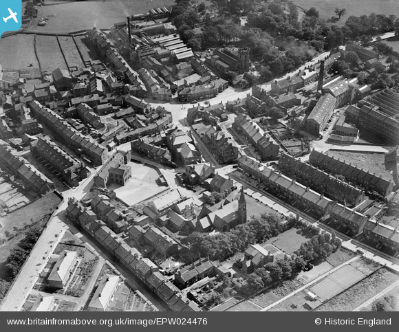
EPW024476 ENGLAND (1928). Oxford Street, Trinity Methodist Church and environs, Guiseley, 1928.
© Hawlfraint cyfranwyr OpenStreetMap a thrwyddedwyd gan yr OpenStreetMap Foundation. 2025. Trwyddedir y gartograffeg fel CC BY-SA.
Delweddau cyfagos (3)
EPW024476

EPW024473

EPW024474

Manylion
| Pennawd | [EPW024476] Oxford Street, Trinity Methodist Church and environs, Guiseley, 1928. |
| Cyfeirnod | EPW024476 |
| Dyddiad | September-1928 |
| Dolen | |
| Enw lle | GUISELEY |
| Plwyf | |
| Ardal | |
| Gwlad | ENGLAND |
| Dwyreiniad / Gogleddiad | 419293, 442243 |
| Hydred / Lledred | -1.7065169549873, 53.875823184906 |
| Cyfeirnod Grid Cenedlaethol | SE193422 |
Pinnau

brian triffitt |
Tuesday 16th of September 2014 09:32:56 PM | |
|
brian triffitt |
Tuesday 16th of September 2014 09:29:44 PM | |
|
brian triffitt |
Tuesday 16th of September 2014 09:22:20 PM | |
|
Brian |
Monday 15th of September 2014 03:15:15 PM | |
|
Brian |
Monday 15th of September 2014 03:13:32 PM |