
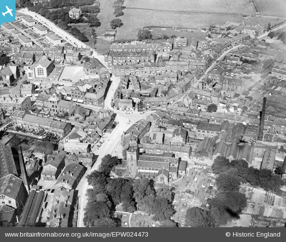
EPW024473 ENGLAND (1928). Town Gate, St Oswald's Church and environs, Guiseley, 1928.
© Hawlfraint cyfranwyr OpenStreetMap a thrwyddedwyd gan yr OpenStreetMap Foundation. 2025. Trwyddedir y gartograffeg fel CC BY-SA.
Delweddau cyfagos (3)
EPW024473

EPW024476

EPW024474

Manylion
| Pennawd | [EPW024473] Town Gate, St Oswald's Church and environs, Guiseley, 1928. |
| Cyfeirnod | EPW024473 |
| Dyddiad | September-1928 |
| Dolen | |
| Enw lle | GUISELEY |
| Plwyf | |
| Ardal | |
| Gwlad | ENGLAND |
| Dwyreiniad / Gogleddiad | 419377, 442231 |
| Hydred / Lledred | -1.7052399331433, 53.875712188741 |
| Cyfeirnod Grid Cenedlaethol | SE194422 |
Pinnau

Kev |
Friday 27th of June 2025 12:28:27 PM | |
|
elisar |
Tuesday 7th of January 2014 10:02:32 PM | |
|
Rolling Loop |
Wednesday 27th of June 2012 04:08:57 PM | |
|
Lootz |
Tuesday 26th of June 2012 09:20:12 PM | |
|
Lootz |
Tuesday 26th of June 2012 09:15:31 PM |