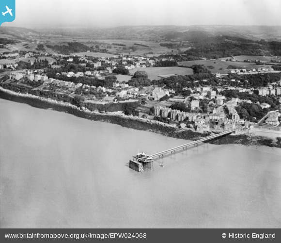
EPW024068 ENGLAND (1928). The Pier and Dial Hill, Clevedon, from the west, 1928
© Hawlfraint cyfranwyr OpenStreetMap a thrwyddedwyd gan yr OpenStreetMap Foundation. 2025. Trwyddedir y gartograffeg fel CC BY-SA.
Delweddau cyfagos (5)
EPW024068

EPW024065

EPW024062

EPW033270

EPW008632

Manylion
| Pennawd | [EPW024068] The Pier and Dial Hill, Clevedon, from the west, 1928 |
| Cyfeirnod | EPW024068 |
| Dyddiad | September-1928 |
| Dolen | |
| Enw lle | CLEVEDON |
| Plwyf | CLEVEDON |
| Ardal | |
| Gwlad | ENGLAND |
| Dwyreiniad / Gogleddiad | 339943, 171992 |
| Hydred / Lledred | -2.8642330711255, 51.44324153167 |
| Cyfeirnod Grid Cenedlaethol | ST399720 |