
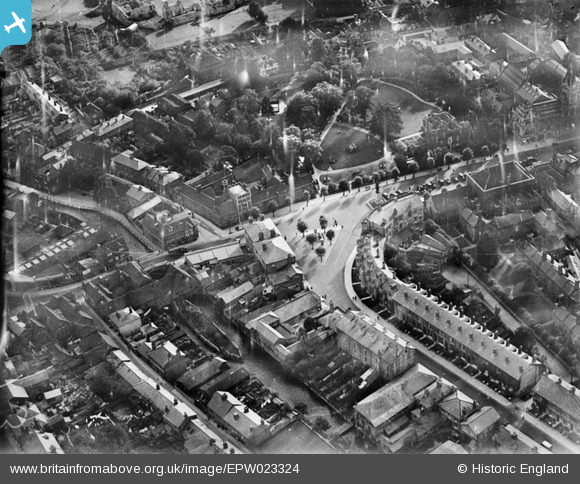
EPW023324 ENGLAND (1928). The junction of the High Street and Bridge Street, Winchester, 1928
© Hawlfraint cyfranwyr OpenStreetMap a thrwyddedwyd gan yr OpenStreetMap Foundation. 2026. Trwyddedir y gartograffeg fel CC BY-SA.
Delweddau cyfagos (7)
EPW023324

EPW023329

EAW051300

EAW008850

EAW022308

EAW035261

EAW035262

Manylion
| Pennawd | [EPW023324] The junction of the High Street and Bridge Street, Winchester, 1928 |
| Cyfeirnod | EPW023324 |
| Dyddiad | September-1928 |
| Dolen | |
| Enw lle | WINCHESTER |
| Plwyf | |
| Ardal | |
| Gwlad | ENGLAND |
| Dwyreiniad / Gogleddiad | 448556, 129321 |
| Hydred / Lledred | -1.3070459037831, 51.060637440561 |
| Cyfeirnod Grid Cenedlaethol | SU486293 |
Pinnau

David960 |
Thursday 29th of January 2015 05:57:05 PM | |

Class31 |
Friday 26th of September 2014 07:55:36 PM | |
|
Class31 |
Friday 26th of September 2014 07:54:44 PM | |
|
Class31 |
Friday 26th of September 2014 07:54:02 PM | |

Alan McFaden |
Monday 25th of November 2013 06:32:06 PM | |
|
RG |
Tuesday 26th of June 2012 08:59:44 AM | |
|
RG |
Tuesday 26th of June 2012 08:58:43 AM |


Cyfraniadau Grŵp
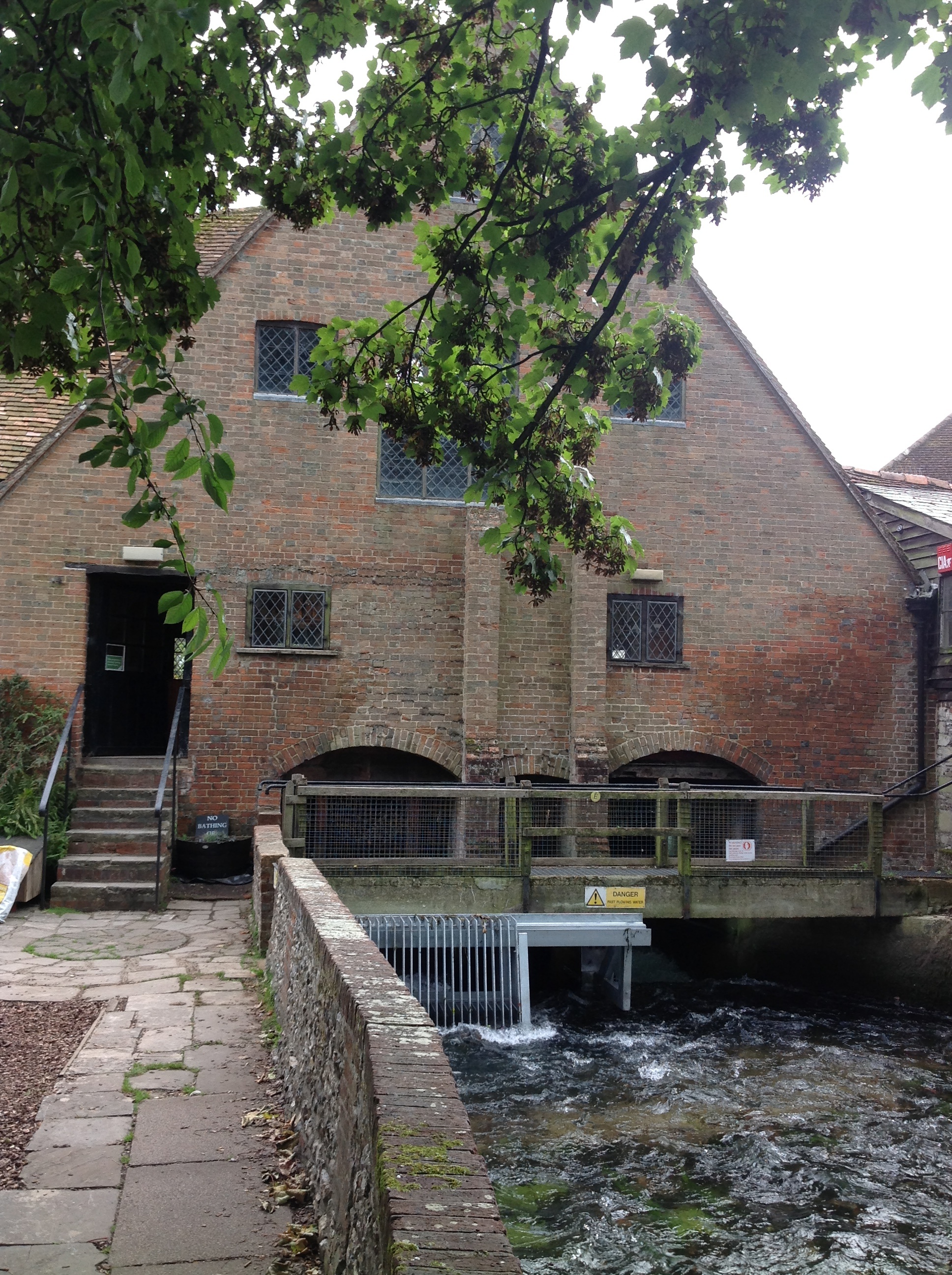
City Mill, Winchester, 25/09/2014 |
Class31 |
Friday 26th of September 2014 07:53:24 PM |
Can see the weirs and Abbet Grounds and the tree lined island leads to Easgate Street. The small lane in the bottom left hand corner must be Water Lane which had the Itchen River along one side. There was a large derelict mill at the end of Water Lane which provided hours of adventure for local children in the 40s ad 50s. |
cook |
Saturday 30th of June 2012 03:12:22 PM |