
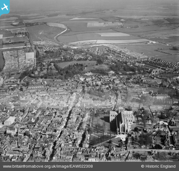
EAW022308 ENGLAND (1949). The High Street and Cathedral of the Holy Trinity looking towards St Giles's Hill, Winchester, from the west, 1949
© Hawlfraint cyfranwyr OpenStreetMap a thrwyddedwyd gan yr OpenStreetMap Foundation. 2026. Trwyddedir y gartograffeg fel CC BY-SA.
Delweddau cyfagos (21)
EAW022308

EAW051297

EAW008850

EAW035274

EPW016870

EPW023325

EPW044868

EAW035273

EAW035272

EAW008847

EAW008846

EAW035271

EPW023318

EAW051303

EAW051299

EAW051300

EPW023329

EPW005114A

EPW023324

EAW035261

EAW035262

Manylion
| Pennawd | [EAW022308] The High Street and Cathedral of the Holy Trinity looking towards St Giles's Hill, Winchester, from the west, 1949 |
| Cyfeirnod | EAW022308 |
| Dyddiad | 18-April-1949 |
| Dolen | |
| Enw lle | WINCHESTER |
| Plwyf | |
| Ardal | |
| Gwlad | ENGLAND |
| Dwyreiniad / Gogleddiad | 448316, 129332 |
| Hydred / Lledred | -1.3104692645846, 51.060756611711 |
| Cyfeirnod Grid Cenedlaethol | SU483293 |
Pinnau

redmist |
Saturday 23rd of December 2023 08:09:22 PM | |
|
flubber |
Friday 27th of December 2013 07:52:27 PM | |

Alan McFaden |
Wednesday 25th of December 2013 09:28:05 PM |
