
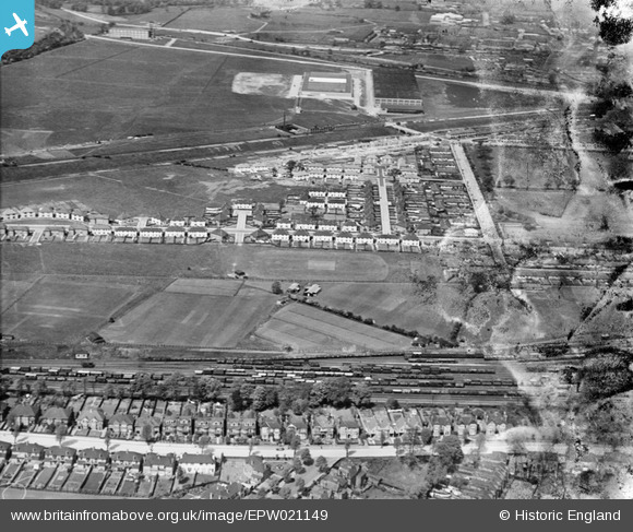
EPW021149 ENGLAND (1928). Acton Housing Estate, Acton, from the south-east, 1928
© Hawlfraint cyfranwyr OpenStreetMap a thrwyddedwyd gan yr OpenStreetMap Foundation. 2026. Trwyddedir y gartograffeg fel CC BY-SA.
Delweddau cyfagos (9)
EPW021149

EPW021154

EPW020881

EPW021152

EPW021151

EPW021148

EPW020880

EPW021153

EPW020878

Manylion
| Pennawd | [EPW021149] Acton Housing Estate, Acton, from the south-east, 1928 |
| Cyfeirnod | EPW021149 |
| Dyddiad | April-1928 |
| Dolen | |
| Enw lle | ACTON |
| Plwyf | |
| Ardal | |
| Gwlad | ENGLAND |
| Dwyreiniad / Gogleddiad | 519884, 181193 |
| Hydred / Lledred | -0.27203550567864, 51.516440051643 |
| Cyfeirnod Grid Cenedlaethol | TQ199812 |
Pinnau

Adrian Wadley |
Tuesday 26th of June 2012 04:52:45 AM |