
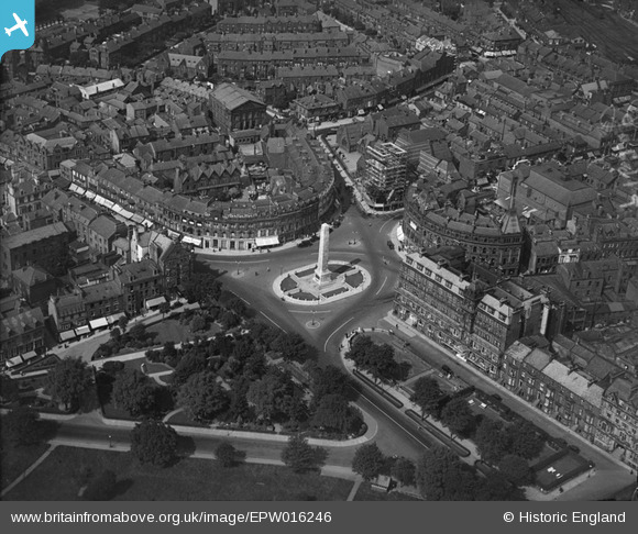
EPW016246 ENGLAND (1926). The War Memorial, Harrogate, 1926
© Hawlfraint cyfranwyr OpenStreetMap a thrwyddedwyd gan yr OpenStreetMap Foundation. 2026. Trwyddedir y gartograffeg fel CC BY-SA.
Delweddau cyfagos (17)
EPW016246

EPW023552

EPW016250

EPW043175

EPW043176

EPW015801

EPW015799

EPW043174

EPW023553

EAW025655

EAW025654

EAW025649

EAW025652

EPW043182

EAW025651

EAW025648

EPW043183

Manylion
| Pennawd | [EPW016246] The War Memorial, Harrogate, 1926 |
| Cyfeirnod | EPW016246 |
| Dyddiad | 14-July-1926 |
| Dolen | |
| Enw lle | HARROGATE |
| Plwyf | |
| Ardal | |
| Gwlad | ENGLAND |
| Dwyreiniad / Gogleddiad | 430134, 455302 |
| Hydred / Lledred | -1.5403213241319, 53.992687809916 |
| Cyfeirnod Grid Cenedlaethol | SE301553 |
Pinnau

aoxomoxoa |
Saturday 4th of October 2014 02:27:25 PM | |
|
aoxomoxoa |
Saturday 4th of October 2014 02:26:25 PM | |
|
aoxomoxoa |
Saturday 4th of October 2014 02:24:08 PM | |
|
aoxomoxoa |
Saturday 4th of October 2014 02:22:25 PM | |
|
aoxomoxoa |
Saturday 4th of October 2014 02:21:55 PM | |
|
aoxomoxoa |
Saturday 4th of October 2014 02:21:07 PM | |
|
aoxomoxoa |
Saturday 4th of October 2014 02:17:58 PM |