
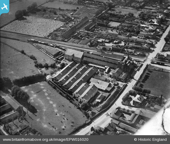
EPW016020 ENGLAND (1926). Gaymers Cider Works, Attleborough, 1926
© Hawlfraint cyfranwyr OpenStreetMap a thrwyddedwyd gan yr OpenStreetMap Foundation. 2025. Trwyddedir y gartograffeg fel CC BY-SA.
Delweddau cyfagos (14)
EPW016020

EPW016026

EPW016024

EPW039235

EPW039231

EPW016025

EPW016027

EPW039230

EPW016021

EPW039229

EPW016023

EPW016028

EPW016019

EPW016022

Manylion
| Pennawd | [EPW016020] Gaymers Cider Works, Attleborough, 1926 |
| Cyfeirnod | EPW016020 |
| Dyddiad | 1-July-1926 |
| Dolen | |
| Enw lle | ATTLEBOROUGH |
| Plwyf | ATTLEBOROUGH |
| Ardal | |
| Gwlad | ENGLAND |
| Dwyreiniad / Gogleddiad | 605127, 294908 |
| Hydred / Lledred | 1.0233172186403, 52.513030057245 |
| Cyfeirnod Grid Cenedlaethol | TM051949 |
Pinnau

Class31 |
Wednesday 30th of January 2013 10:12:25 AM | |
|
Class31 |
Wednesday 30th of January 2013 10:04:49 AM | |

MB |
Sunday 30th of September 2012 10:46:36 PM | |
|
MB |
Sunday 30th of September 2012 10:45:33 PM | |
|
MB |
Sunday 30th of September 2012 10:45:08 PM | |
|
MB |
Sunday 30th of September 2012 10:43:53 PM | |
|
MB |
Sunday 30th of September 2012 10:41:02 PM |