
EPW013696 ENGLAND (1925). Bidston Hill and environs, Bidston, 1925
© Hawlfraint cyfranwyr OpenStreetMap a thrwyddedwyd gan yr OpenStreetMap Foundation. 2026. Trwyddedir y gartograffeg fel CC BY-SA.
Delweddau cyfagos (5)
EPW013696

EPW013694

EPW013698

EPW013697

EPW013695

Manylion
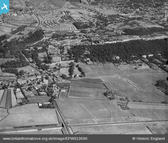
| Pennawd | [EPW013696] Bidston Hill and environs, Bidston, 1925 |
| Cyfeirnod | EPW013696 |
| Dyddiad | 12-July-1925 |
| Dolen | |
| Enw lle | BIDSTON |
| Plwyf | |
| Ardal | |
| Gwlad | ENGLAND |
| Dwyreiniad / Gogleddiad | 328416, 390040 |
| Hydred / Lledred | -3.0768115140781, 53.402061156329 |
| Cyfeirnod Grid Cenedlaethol | SJ284900 |
Pinnau

dd |
Sunday 17th of September 2023 09:31:28 PM | |
|
dd |
Sunday 17th of September 2023 09:30:54 PM | |
|
dd |
Sunday 17th of September 2023 09:21:10 PM | |
|
BobH |
Thursday 7th of July 2016 05:59:15 PM | |
|
Skafloc |
Friday 5th of June 2015 10:00:45 PM | |
|
Steve |
Friday 7th of February 2014 11:56:34 AM | |
|
Mike |
Friday 31st of January 2014 11:27:25 PM | |
|
kinmel |
Saturday 21st of December 2013 10:22:34 PM | |
|
kinmel |
Saturday 21st of December 2013 10:20:06 PM | |
|
beast66606 |
Friday 13th of September 2013 09:23:17 AM | |
|
terry |
Wednesday 23rd of January 2013 10:00:07 PM |
Cyfraniadau Grŵp
Looking from the bottom of the photo towards the top one can see Bidston Observatory and lighthouse. Above that is, I believe Percy Cottage (two white squares) since demolished. Above that are a multitude of white squares amongst trees which are the gravestones of Flaybrick cemetery, the steeple of the church can be seen on the far right. |
Mike |
Friday 31st of January 2014 10:01:59 PM |