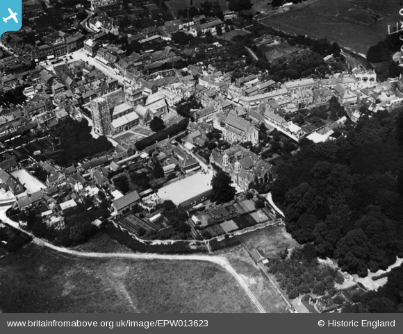
EPW013623 ENGLAND (1925). Queen Elizabeth's Free Grammar School, the Minster Church of St Cuthberga and the town, Wimborne, 1925. This image has been produced from a print.
© Hawlfraint cyfranwyr OpenStreetMap a thrwyddedwyd gan yr OpenStreetMap Foundation. 2026. Trwyddedir y gartograffeg fel CC BY-SA.
Delweddau cyfagos (7)
EPW013623

EPW013620

EAW024379

EAW024381

EAW024382

EPW013621

EAW024380

Manylion
| Pennawd | [EPW013623] Queen Elizabeth's Free Grammar School, the Minster Church of St Cuthberga and the town, Wimborne, 1925. This image has been produced from a print. |
| Cyfeirnod | EPW013623 |
| Dyddiad | June-1925 |
| Dolen | |
| Enw lle | WIMBORNE |
| Plwyf | WIMBORNE MINSTER |
| Ardal | |
| Gwlad | ENGLAND |
| Dwyreiniad / Gogleddiad | 400942, 99852 |
| Hydred / Lledred | -1.98663215287, 50.797664585479 |
| Cyfeirnod Grid Cenedlaethol | SZ009999 |
Pinnau
Byddwch y cyntaf i ychwanegu sylw at y ddelwedd hon!