
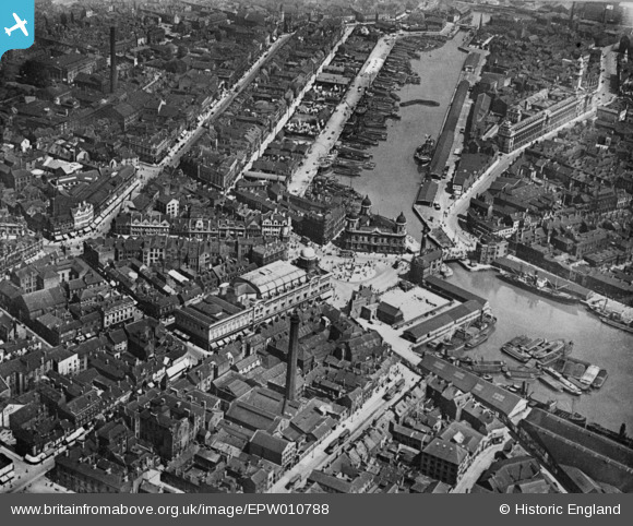
EPW010788 ENGLAND (1924). City Hall, Queen's Dock and environs, Kingston upon Hull, 1924. This image has been produced from a copy-negative.
© Hawlfraint cyfranwyr OpenStreetMap a thrwyddedwyd gan yr OpenStreetMap Foundation. 2026. Trwyddedir y gartograffeg fel CC BY-SA.
Delweddau cyfagos (9)
EPW010788

EPW012805

EPW036496

EPW012693

EPW036495

EPW036497

EPW012811

EAW015657

EPW010789

Manylion
| Pennawd | [EPW010788] City Hall, Queen's Dock and environs, Kingston upon Hull, 1924. This image has been produced from a copy-negative. |
| Cyfeirnod | EPW010788 |
| Dyddiad | June-1924 |
| Dolen | |
| Enw lle | KINGSTON UPON HULL |
| Plwyf | |
| Ardal | |
| Gwlad | ENGLAND |
| Dwyreiniad / Gogleddiad | 509640, 428801 |
| Hydred / Lledred | -0.33733188228979, 53.743819331255 |
| Cyfeirnod Grid Cenedlaethol | TA096288 |
Pinnau

John Wass |
Friday 3rd of April 2015 09:04:30 PM |