
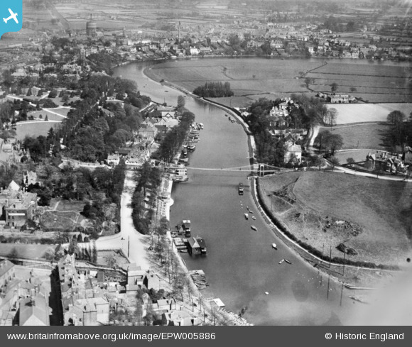
EPW005886 ENGLAND (1921). Queen's Park Suspension Bridge and the River Dee, Chester, 1921. This image has been produced from a copy-negative.
© Hawlfraint cyfranwyr OpenStreetMap a thrwyddedwyd gan yr OpenStreetMap Foundation. 2026. Trwyddedir y gartograffeg fel CC BY-SA.
Delweddau cyfagos (10)
EPW005886

EPW003095

EPW005887

EPW004010

EPW040163

EPW005882

EPW040165

EPW004004

EPW029589

EPW003098

Manylion
| Pennawd | [EPW005886] Queen's Park Suspension Bridge and the River Dee, Chester, 1921. This image has been produced from a copy-negative. |
| Cyfeirnod | EPW005886 |
| Dyddiad | March-1921 |
| Dolen | |
| Enw lle | CHESTER |
| Plwyf | |
| Ardal | |
| Gwlad | ENGLAND |
| Dwyreiniad / Gogleddiad | 341026, 366019 |
| Hydred / Lledred | -2.8826886567687, 53.18770339308 |
| Cyfeirnod Grid Cenedlaethol | SJ410660 |
Pinnau
Byddwch y cyntaf i ychwanegu sylw at y ddelwedd hon!