
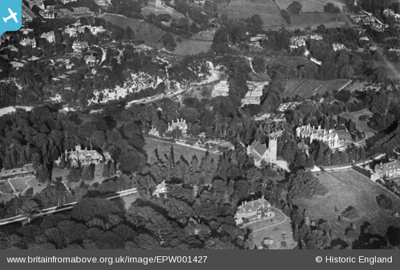
EPW001427 ENGLAND (1920). St Mary's Church and environs, Kippington, 1920. This image has been produced from a copy-negative.
© Hawlfraint cyfranwyr OpenStreetMap a thrwyddedwyd gan yr OpenStreetMap Foundation. 2026. Trwyddedir y gartograffeg fel CC BY-SA.
Delweddau cyfagos (8)
EPW001427

EAW002353
 and St Mary's Church, Kippington, 1946")
EAW002357
, Kippington, 1946")
EAW002351
, Kippington, 1946")
EAW002350
, Kippington, 1946")
EAW002352
 and environs, Kippington, 1946")
EAW002354
 and environs, Kippington, from the west, 1946")
EAW002355
 and environs, Kippington, from the south, 1946")
Manylion
| Pennawd | [EPW001427] St Mary's Church and environs, Kippington, 1920. This image has been produced from a copy-negative. |
| Cyfeirnod | EPW001427 |
| Dyddiad | 8-June-1920 |
| Dolen | |
| Enw lle | KIPPINGTON |
| Plwyf | SEVENOAKS |
| Ardal | |
| Gwlad | ENGLAND |
| Dwyreiniad / Gogleddiad | 552219, 154727 |
| Hydred / Lledred | 0.1823522267799, 51.270825878024 |
| Cyfeirnod Grid Cenedlaethol | TQ522547 |
