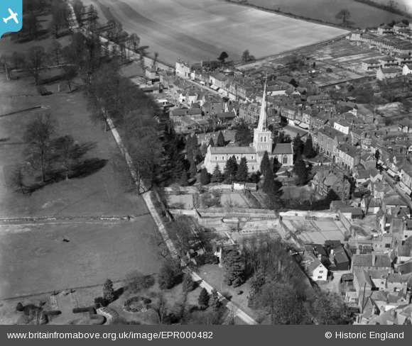
EPR000482 ENGLAND (1935). St Mary's Church and the High Street, Hemel Hempstead, 1935
    © Hawlfraint cyfranwyr OpenStreetMap a thrwyddedwyd gan yr OpenStreetMap Foundation. 2025. Trwyddedir y gartograffeg fel CC BY-SA.
  
Delweddau cyfagos (20)
Manylion
| Pennawd | [EPR000482] St Mary's Church and the High Street, Hemel Hempstead, 1935 | 
| Cyfeirnod | EPR000482 | 
| Dyddiad | 27-March-1935 | 
| Dolen | |
| Enw lle | HEMEL HEMPSTEAD | 
| Plwyf | |
| Ardal | |
| Gwlad | ENGLAND | 
| Dwyreiniad / Gogleddiad | 505483, 207804 | 
| Hydred / Lledred | -0.47149964139373, 51.75852255356 | 
| Cyfeirnod Grid Cenedlaethol | TL055078 | 
Pinnau
Byddwch y cyntaf i ychwanegu sylw at y ddelwedd hon!
 
             
  ![[EPR000482] St Mary's Church and the High Street, Hemel Hempstead, 1935](http://britainfromabove.org.uk/sites/all/libraries/aerofilms-images/public/100x100/EPR/000/EPR000482.jpg) 
  
                                          ![[EAW014881] St Mary's Church and the High Street, Hemel Hempstead, 1948. This image has been produced from a print.](http://britainfromabove.org.uk/sites/all/libraries/aerofilms-images/public/100x100/EAW/014/EAW014881.jpg) 
 ![[EAW017261] The town, Hemel Hempstead, from the north-west, 1948. This image has been produced from a print.](http://britainfromabove.org.uk/sites/all/libraries/aerofilms-images/public/100x100/EAW/017/EAW017261.jpg) 
 ![[EAW017260] The town, Hemel Hempstead, from the north, 1948. This image has been produced from a print.](http://britainfromabove.org.uk/sites/all/libraries/aerofilms-images/public/100x100/EAW/017/EAW017260.jpg) 
 ![[EPW017817] St Mary's Church, Hemel Hempstead, 1927](http://britainfromabove.org.uk/sites/all/libraries/aerofilms-images/public/100x100/EPW/017/EPW017817.jpg) 
 ![[EAW017256] The town, Hemel Hempstead, from the north-west, 1948. This image has been produced from a print.](http://britainfromabove.org.uk/sites/all/libraries/aerofilms-images/public/100x100/EAW/017/EAW017256.jpg) 
 ![[EAW017252] The town, Hemel Hempstead, from the north-west, 1948. This image has been produced from a print.](http://britainfromabove.org.uk/sites/all/libraries/aerofilms-images/public/100x100/EAW/017/EAW017252.jpg) 
 ![[EAW014882] St Mary's Church, the High Street and environs, Hemel Hempstead, 1948. This image has been produced from a print.](http://britainfromabove.org.uk/sites/all/libraries/aerofilms-images/public/100x100/EAW/014/EAW014882.jpg) 
 ![[EAW017255] The town, Hemel Hempstead, from the north-west, 1948. This image has been produced from a print.](http://britainfromabove.org.uk/sites/all/libraries/aerofilms-images/public/100x100/EAW/017/EAW017255.jpg) 
 ![[EAW017257] The town, Hemel Hempstead, from the north-west, 1948. This image has been produced from a print.](http://britainfromabove.org.uk/sites/all/libraries/aerofilms-images/public/100x100/EAW/017/EAW017257.jpg) 
 ![[EPW017820] St Mary's Church and the High Street, Hemel Hempstead, 1927](http://britainfromabove.org.uk/sites/all/libraries/aerofilms-images/public/100x100/EPW/017/EPW017820.jpg) 
 ![[EPW017818] St Mary's Church and the High Street, Hemel Hempstead, 1927](http://britainfromabove.org.uk/sites/all/libraries/aerofilms-images/public/100x100/EPW/017/EPW017818.jpg) 
 ![[EAW017253] The town, Hemel Hempstead, from the north-west, 1948. This image has been produced from a print.](http://britainfromabove.org.uk/sites/all/libraries/aerofilms-images/public/100x100/EAW/017/EAW017253.jpg) 
 ![[EAW017251] The town, Hemel Hempstead, from the north-west, 1948. This image has been produced from a print.](http://britainfromabove.org.uk/sites/all/libraries/aerofilms-images/public/100x100/EAW/017/EAW017251.jpg) 
 ![[EAW017254] The town, Hemel Hempstead, from the north-west, 1948. This image has been produced from a print.](http://britainfromabove.org.uk/sites/all/libraries/aerofilms-images/public/100x100/EAW/017/EAW017254.jpg) 
 ![[EPW052866] The Junction of Marlowes and Bury Road (Queensway) and environs, Hemel Hempstead, 1937](http://britainfromabove.org.uk/sites/all/libraries/aerofilms-images/public/100x100/EPW/052/EPW052866.jpg) 
 ![[EPW052865] The Junction of Marlowes and Bury Road (Queensway), Hemel Hempstead, 1937](http://britainfromabove.org.uk/sites/all/libraries/aerofilms-images/public/100x100/EPW/052/EPW052865.jpg) 
 ![[EAW014883] Marlowes, Queensway and environs, Hemel Hempstead, 1948. This image has been produced from a print.](http://britainfromabove.org.uk/sites/all/libraries/aerofilms-images/public/100x100/EAW/014/EAW014883.jpg) 
 ![[EAW014884] The town, Hemel Hempstead, from the south-west, 1948. This image has been produced from a print.](http://britainfromabove.org.uk/sites/all/libraries/aerofilms-images/public/100x100/EAW/014/EAW014884.jpg) 
 ![[EPW022457] The town centre, Hemel Hempstead, 1928](http://britainfromabove.org.uk/sites/all/libraries/aerofilms-images/public/100x100/EPW/022/EPW022457.jpg)