
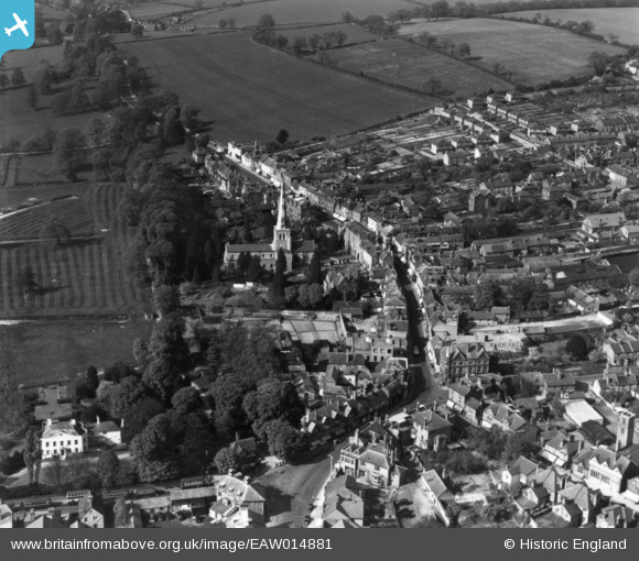
EAW014881 ENGLAND (1948). St Mary's Church and the High Street, Hemel Hempstead, 1948. This image has been produced from a print.
© Hawlfraint cyfranwyr OpenStreetMap a thrwyddedwyd gan yr OpenStreetMap Foundation. 2026. Trwyddedir y gartograffeg fel CC BY-SA.
Delweddau cyfagos (20)
EAW014881

EPW017817

EPR000482

EAW014882

EPW017820

EAW017260

EAW017261

EAW017256

EAW017252

EPW017818

EAW017255

EAW017257

EAW017251

EPW052866
 and environs, Hemel Hempstead, 1937")
EAW017253

EAW017254

EAW014883

EPW052865
, Hemel Hempstead, 1937")
EAW014884

EPW022457

Manylion
| Pennawd | [EAW014881] St Mary's Church and the High Street, Hemel Hempstead, 1948. This image has been produced from a print. |
| Cyfeirnod | EAW014881 |
| Dyddiad | 27-April-1948 |
| Dolen | |
| Enw lle | HEMEL HEMPSTEAD |
| Plwyf | |
| Ardal | |
| Gwlad | ENGLAND |
| Dwyreiniad / Gogleddiad | 505524, 207810 |
| Hydred / Lledred | -0.47090393731578, 51.758568761657 |
| Cyfeirnod Grid Cenedlaethol | TL055078 |
Pinnau

H.E. |
Monday 12th of January 2015 08:56:52 PM |