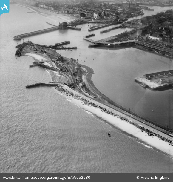
EAW052980 ENGLAND (1953). The Outer Harbour, North Beach and Waveney Dock, Lowestoft, 1953
    © Hawlfraint cyfranwyr OpenStreetMap a thrwyddedwyd gan yr OpenStreetMap Foundation. 2025. Trwyddedir y gartograffeg fel CC BY-SA.
  
Delweddau cyfagos (6)
Manylion
| Pennawd | [EAW052980] The Outer Harbour, North Beach and Waveney Dock, Lowestoft, 1953 | 
| Cyfeirnod | EAW052980 | 
| Dyddiad | 19-December-1953 | 
| Dolen | |
| Enw lle | LOWESTOFT | 
| Plwyf | |
| Ardal | |
| Gwlad | ENGLAND | 
| Dwyreiniad / Gogleddiad | 655409, 292936 | 
| Hydred / Lledred | 1.7613339775909, 52.474109250425 | 
| Cyfeirnod Grid Cenedlaethol | TM554929 | 
Pinnau
|  WWII Anti Tank Blocks re-used as sea defences. |   cptpies | Friday 21st of November 2014 08:42:20 AM | 
Cyfraniadau Grŵp
|   cptpies | Friday 21st of November 2014 08:43:18 AM | 
 
             
  ![[EAW052980] The Outer Harbour, North Beach and Waveney Dock, Lowestoft, 1953](http://britainfromabove.org.uk/sites/all/libraries/aerofilms-images/public/100x100/EAW/052/EAW052980.jpg) 
  
                                          ![[EPW021254] Hamilton Dock and the town, Lowestoft, from the south-east, 1928](http://britainfromabove.org.uk/sites/all/libraries/aerofilms-images/public/100x100/EPW/021/EPW021254.jpg) 
 ![[EAW005065] The Outer Harbour, Waveney Dock, Hamilton Dock and environs, Lowestoft, from the north-east, 1947](http://britainfromabove.org.uk/sites/all/libraries/aerofilms-images/public/100x100/EAW/005/EAW005065.jpg) 
 ![[EAW052977] Hamilton Dock, Lowestoft, 1953](http://britainfromabove.org.uk/sites/all/libraries/aerofilms-images/public/100x100/EAW/052/EAW052977.jpg) 
 ![[EAW047638] North Beach and the entrance to the Outer Harbour, Lowestoft, 1952](http://britainfromabove.org.uk/sites/all/libraries/aerofilms-images/public/100x100/EAW/047/EAW047638.jpg) 
 ![[EAW047642] Fishing ships moored at the Herring and Mackerel Market in Waveney Dock, Lowestoft, 1952](http://britainfromabove.org.uk/sites/all/libraries/aerofilms-images/public/100x100/EAW/047/EAW047642.jpg) 
 