
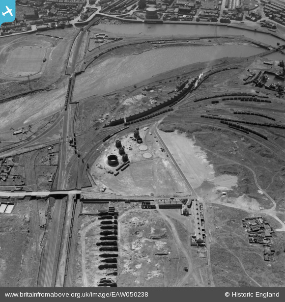
EAW050238 ENGLAND (1953). An oil depot under construction near Prince of Wales Dock, Workington, 1953
© Hawlfraint cyfranwyr OpenStreetMap a thrwyddedwyd gan yr OpenStreetMap Foundation. 2026. Trwyddedir y gartograffeg fel CC BY-SA.
Delweddau cyfagos (13)
EAW050238

EAW050240

EAW050244

EAW050239

EAW050243

EAW050242

EAW050237

EAW050246

EAW050247

EAW050245

EAW050241

EAW050236

EAW050235

Manylion
| Pennawd | [EAW050238] An oil depot under construction near Prince of Wales Dock, Workington, 1953 |
| Cyfeirnod | EAW050238 |
| Dyddiad | 29-June-1953 |
| Dolen | |
| Enw lle | WORKINGTON |
| Plwyf | WORKINGTON |
| Ardal | |
| Gwlad | ENGLAND |
| Dwyreiniad / Gogleddiad | 299506, 529533 |
| Hydred / Lledred | -3.5577060427244, 54.650756017982 |
| Cyfeirnod Grid Cenedlaethol | NX995295 |
Pinnau

Hammer1980 |
Thursday 5th of March 2026 12:18:38 AM | |
|
Keith T |
Tuesday 26th of May 2015 08:35:53 PM | |
|
MB |
Tuesday 1st of July 2014 09:49:00 AM | |
|
MB |
Tuesday 1st of July 2014 09:47:40 AM | |

Maurice |
Tuesday 1st of July 2014 07:43:06 AM | |
|
Maurice |
Tuesday 1st of July 2014 07:39:11 AM | |
Wrong again I'm afraid. This is the main railway bridge over the River Derwent and is still used daily by trains from Barrow to Carlisle. In the 2009 floods of Workington this was the only means of getting across the river for people living north of the river. A temporary station was set-up north of the area shown and was used by hundreds of people on a daily basis to save having to make a 30 mile route to Workington. |
Keith T |
Wednesday 27th of May 2015 06:45:21 PM |
I wish people would stop making daft comments, Ha'penny Billy (that is the bridge in question!) has NOT been removed |
BillyMc |
Monday 23rd of November 2015 01:31:57 PM |
|
Maurice |
Tuesday 1st of July 2014 07:38:31 AM | |
|
Maurice |
Tuesday 1st of July 2014 07:36:16 AM | |
There was no railway track over these brick pillars. There was a high wall on the front side as we see it and behind the wall there was several store buildings. In fact my father had one of the store buildings in 1948 for a garage. Also on the front of the wall was the weighbridge where the wagons were weighed before they were taken over to the Moss Bay Steelworks. |
Keith T |
Tuesday 26th of May 2015 08:30:51 PM |
Please stop guessing! There was NO railway, or anything else over these "piers" It is known locally as the "Lowther Wall" and was used as storage for the different ores used by the nearby (disused and demolished) Lowther iron works |
BillyMc |
Saturday 28th of January 2017 05:50:33 PM |
|
Maurice |
Tuesday 1st of July 2014 07:34:51 AM | |
Please stop guessing and do your research properly. These were disused bays for an abandoned iron & steel works. There were three iron & steel works on both sides of the Whitehaven Junction Section of the BR Main Coast line. All were north of the river. When the Workington Iron & Steel Company was formed all production was eventually moved to the Moss Bay site which was approx 2 miles to the south. Most of your guesses are wrong and the correct answers are contained in Lancaster & Shuttleworth's out of print book about steel making in West Cumberland |
Tom Jenkins |
Saturday 14th of February 2015 09:18:33 PM |
When we were kids back in the early 60's, we knew these as the "Bunkers" . We were always lead to believe that they were the bays for different ores for use in Oldside iron Works |
BillyMc |
Saturday 24th of October 2015 07:23:39 PM |
|
Maurice |
Tuesday 1st of July 2014 07:34:21 AM |