
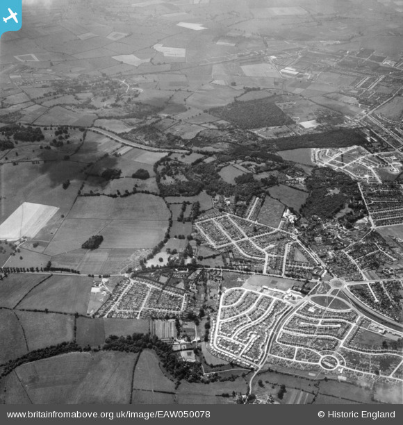
EAW050078 ENGLAND (1953). Shotover Hill and housing development at Risinghurst and Sandhills, Risinghurst, 1953
© Hawlfraint cyfranwyr OpenStreetMap a thrwyddedwyd gan yr OpenStreetMap Foundation. 2026. Trwyddedir y gartograffeg fel CC BY-SA.
Delweddau cyfagos (2)
EAW050078

EAW050076

Manylion
| Pennawd | [EAW050078] Shotover Hill and housing development at Risinghurst and Sandhills, Risinghurst, 1953 |
| Cyfeirnod | EAW050078 |
| Dyddiad | 26-June-1953 |
| Dolen | |
| Enw lle | RISINGHURST |
| Plwyf | RISINGHURST AND SANDHILLS |
| Ardal | |
| Gwlad | ENGLAND |
| Dwyreiniad / Gogleddiad | 456261, 206774 |
| Hydred / Lledred | -1.1848053826527, 51.756372008544 |
| Cyfeirnod Grid Cenedlaethol | SP563068 |
Pinnau

J May |
Tuesday 24th of March 2026 01:08:52 PM | |
|
J May |
Tuesday 24th of March 2026 12:59:29 PM | |
|
J May |
Tuesday 24th of March 2026 12:57:53 PM | |
|
J May |
Tuesday 24th of March 2026 12:56:35 PM | |
|
J May |
Tuesday 24th of March 2026 12:55:30 PM | |
|
J May |
Tuesday 24th of March 2026 12:54:27 PM | |
|
J May |
Tuesday 24th of March 2026 12:53:30 PM | |
|
J May |
Tuesday 24th of March 2026 12:52:18 PM | |
|
J May |
Tuesday 24th of March 2026 12:51:27 PM | |
|
J May |
Tuesday 24th of March 2026 12:50:04 PM | |
|
J May |
Tuesday 24th of March 2026 12:47:30 PM | |
|
J May |
Tuesday 24th of March 2026 12:45:43 PM | |
|
J May |
Tuesday 24th of March 2026 12:41:14 PM | |
|
David Brimson |
Monday 12th of May 2025 02:48:37 PM | |
|
David Brimson |
Monday 12th of May 2025 02:47:41 PM |