
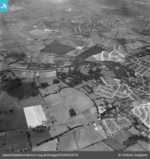
EAW050076 ENGLAND (1953). Housing development around Monk's Wood and Magdalen Wood, Shotover Hill, 1953
© Hawlfraint cyfranwyr OpenStreetMap a thrwyddedwyd gan yr OpenStreetMap Foundation. 2026. Trwyddedir y gartograffeg fel CC BY-SA.
Delweddau cyfagos (2)
EAW050076

EAW050078

Manylion
| Pennawd | [EAW050076] Housing development around Monk's Wood and Magdalen Wood, Shotover Hill, 1953 |
| Cyfeirnod | EAW050076 |
| Dyddiad | 26-June-1953 |
| Dolen | |
| Enw lle | SHOTOVER HILL |
| Plwyf | FOREST HILL WITH SHOTOVER |
| Ardal | |
| Gwlad | ENGLAND |
| Dwyreiniad / Gogleddiad | 456305, 206606 |
| Hydred / Lledred | -1.1841951336026, 51.754857063814 |
| Cyfeirnod Grid Cenedlaethol | SP563066 |
Pinnau
Byddwch y cyntaf i ychwanegu sylw at y ddelwedd hon!