
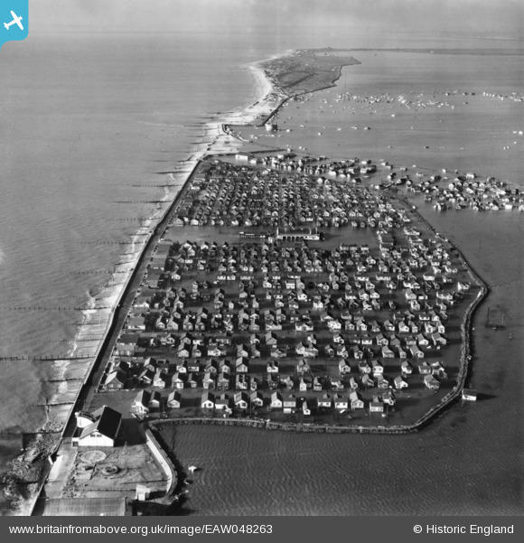
EAW048263 ENGLAND (1953). Damaged sea defences and flooding along the Essex coast, Jaywick, from the east, 1953. This image has been produced from a print.
© Hawlfraint cyfranwyr OpenStreetMap a thrwyddedwyd gan yr OpenStreetMap Foundation. 2026. Trwyddedir y gartograffeg fel CC BY-SA.
Delweddau cyfagos (6)
EAW048263

EAW048265

EAW048266

EAW048274

EAW048268

EAW048275

Manylion
| Pennawd | [EAW048263] Damaged sea defences and flooding along the Essex coast, Jaywick, from the east, 1953. This image has been produced from a print. |
| Cyfeirnod | EAW048263 |
| Dyddiad | 2-February-1953 |
| Dolen | |
| Enw lle | JAYWICK |
| Plwyf | |
| Ardal | |
| Gwlad | ENGLAND |
| Dwyreiniad / Gogleddiad | 614542, 212888 |
| Hydred / Lledred | 1.1100862094171, 51.773026843251 |
| Cyfeirnod Grid Cenedlaethol | TM145129 |
Pinnau
Byddwch y cyntaf i ychwanegu sylw at y ddelwedd hon!