
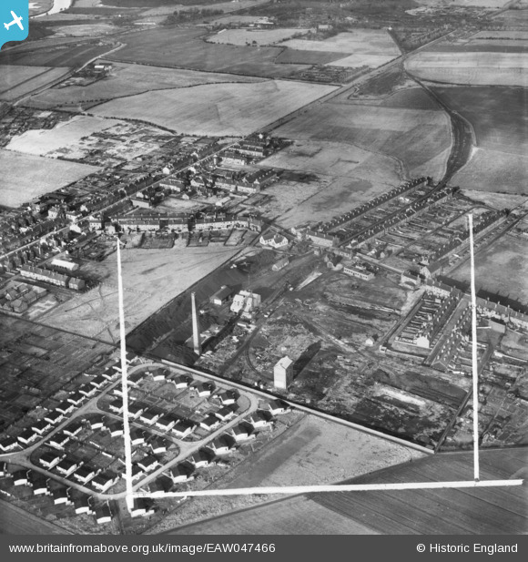
EAW047466 ENGLAND (1952). The Coal Briquette Works and environs, Hopetown, 1952. This image was marked by Aerofilms Ltd for photo editing.
© Hawlfraint cyfranwyr OpenStreetMap a thrwyddedwyd gan yr OpenStreetMap Foundation. 2026. Trwyddedir y gartograffeg fel CC BY-SA.
Delweddau cyfagos (10)
EAW047466

EAW047458

EAW047467

EAW047462

EAW047459

EAW047460

EAW047464

EAW047465

EAW047463

EAW047461

Manylion
| Pennawd | [EAW047466] The Coal Briquette Works and environs, Hopetown, 1952. This image was marked by Aerofilms Ltd for photo editing. |
| Cyfeirnod | EAW047466 |
| Dyddiad | 10-October-1952 |
| Dolen | |
| Enw lle | HOPETOWN |
| Plwyf | NORMANTON |
| Ardal | |
| Gwlad | ENGLAND |
| Dwyreiniad / Gogleddiad | 439815, 423334 |
| Hydred / Lledred | -1.3967960098377, 53.704690038255 |
| Cyfeirnod Grid Cenedlaethol | SE398233 |
Pinnau

drj |
Monday 4th of January 2021 02:07:30 PM | |
|
Cairneymount |
Saturday 13th of June 2020 03:58:02 PM | |
|
dyey |
Thursday 1st of March 2018 08:54:44 PM | |
|
wookie |
Wednesday 26th of July 2017 04:22:13 PM | |
|
ncbnik |
Monday 25th of April 2016 06:02:26 PM | |
|
ncbnik |
Monday 25th of April 2016 06:01:10 PM | |
|
ncbnik |
Monday 25th of April 2016 05:56:28 PM | |
|
ncbnik |
Monday 25th of April 2016 05:52:40 PM |