
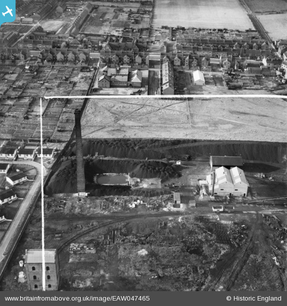
EAW047465 ENGLAND (1952). The Coal Briquette Works, Hopetown, 1952. This image was marked by Aerofilms Ltd for photo editing.
© Hawlfraint cyfranwyr OpenStreetMap a thrwyddedwyd gan yr OpenStreetMap Foundation. 2026. Trwyddedir y gartograffeg fel CC BY-SA.
Delweddau cyfagos (10)
EAW047465

EAW047460

EAW047459

EAW047463

EAW047458

EAW047467

EAW047464

EAW047461

EAW047466

EAW047462

Manylion
| Pennawd | [EAW047465] The Coal Briquette Works, Hopetown, 1952. This image was marked by Aerofilms Ltd for photo editing. |
| Cyfeirnod | EAW047465 |
| Dyddiad | 10-October-1952 |
| Dolen | |
| Enw lle | HOPETOWN |
| Plwyf | NORMANTON |
| Ardal | |
| Gwlad | ENGLAND |
| Dwyreiniad / Gogleddiad | 439702, 423267 |
| Hydred / Lledred | -1.3985164632603, 53.704096404866 |
| Cyfeirnod Grid Cenedlaethol | SE397233 |
