
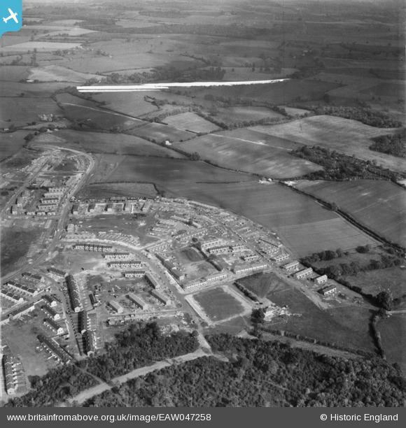
EAW047258 ENGLAND (1952). The residential area at Bedwell East under construction, Bedwell, from the south-west, 1952. This image was marked by Aerofilms Ltd for photo editing.
© Hawlfraint cyfranwyr OpenStreetMap a thrwyddedwyd gan yr OpenStreetMap Foundation. 2026. Trwyddedir y gartograffeg fel CC BY-SA.
Delweddau cyfagos (6)
EAW047258

EAW047257

EAW047259

EAW047256

EAW047255

EAW047254

Manylion
| Pennawd | [EAW047258] The residential area at Bedwell East under construction, Bedwell, from the south-west, 1952. This image was marked by Aerofilms Ltd for photo editing. |
| Cyfeirnod | EAW047258 |
| Dyddiad | 15-October-1952 |
| Dolen | |
| Enw lle | BEDWELL |
| Plwyf | |
| Ardal | |
| Gwlad | ENGLAND |
| Dwyreiniad / Gogleddiad | 524967, 223934 |
| Hydred / Lledred | -0.18348321549959, 51.899481722927 |
| Cyfeirnod Grid Cenedlaethol | TL250239 |
Pinnau
Byddwch y cyntaf i ychwanegu sylw at y ddelwedd hon!