
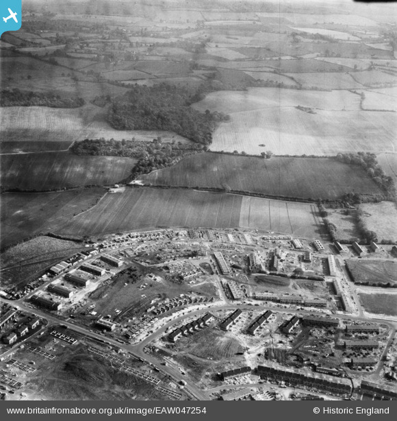
EAW047254 ENGLAND (1952). The residential area at Bedwell East under construction, Bedwell, from the west, 1952
© Hawlfraint cyfranwyr OpenStreetMap a thrwyddedwyd gan yr OpenStreetMap Foundation. 2026. Trwyddedir y gartograffeg fel CC BY-SA.
Delweddau cyfagos (7)
EAW047254

EAW047255

EAW047253

EAW047256

EAW047257

EAW047259

EAW047258

Manylion
| Pennawd | [EAW047254] The residential area at Bedwell East under construction, Bedwell, from the west, 1952 |
| Cyfeirnod | EAW047254 |
| Dyddiad | 15-October-1952 |
| Dolen | |
| Enw lle | BEDWELL |
| Plwyf | |
| Ardal | |
| Gwlad | ENGLAND |
| Dwyreiniad / Gogleddiad | 524974, 224134 |
| Hydred / Lledred | -0.18330899460005, 51.901277626595 |
| Cyfeirnod Grid Cenedlaethol | TL250241 |
Pinnau
Byddwch y cyntaf i ychwanegu sylw at y ddelwedd hon!