
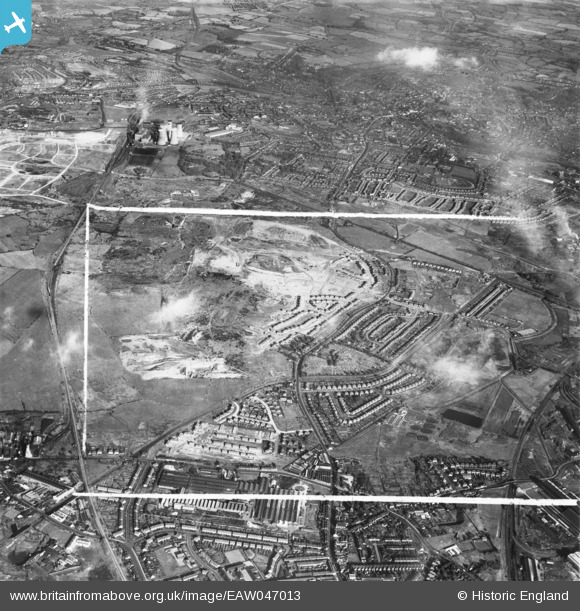
EAW047013 ENGLAND (1952). The residential area surrounding Morris Avenue under construction and environs, Bentley, 1952. This image was marked by Aerofilms Ltd for photo editing.
© Hawlfraint cyfranwyr OpenStreetMap a thrwyddedwyd gan yr OpenStreetMap Foundation. 2026. Trwyddedir y gartograffeg fel CC BY-SA.
Delweddau cyfagos (7)
EAW047013

 0°
0m
0°
0m
EAW000776
 292°
124m
292°
124m
EAW000774
 51°
150m
51°
150m
EAW000770
 241°
201m
241°
201m
EAW000772
 289°
212m
289°
212m
EAW000775
 34°
266m
34°
266m
EAW000778
 35°
272m
35°
272m
Manylion
| Pennawd | [EAW047013] The residential area surrounding Morris Avenue under construction and environs, Bentley, 1952. This image was marked by Aerofilms Ltd for photo editing. |
| Cyfeirnod | EAW047013 |
| Dyddiad | 23-September-1952 |
| Dolen | |
| Enw lle | BENTLEY |
| Plwyf | |
| Ardal | |
| Gwlad | ENGLAND |
| Dwyreiniad / Gogleddiad | 398459, 298892 |
| Hydred / Lledred | -2.0227481591549, 52.587473255969 |
| Cyfeirnod Grid Cenedlaethol | SO985989 |
Pinnau
 Emmanuel Parish Church (built 1954) Emmanuel Parish Church (built 1954) |

phoenixgrl78 |
Wednesday 9th of September 2026 07:30:20 PM |
| Kent Road, Bentley |
phoenixgrl78 |
Wednesday 9th of September 2026 07:26:50 PM |
| Queen Elizabeth Avenue, Bentley |
phoenixgrl78 |
Wednesday 9th of September 2026 07:21:01 PM |
| Churchill Road, Bentley |
phoenixgrl78 |
Wednesday 9th of September 2026 07:19:59 PM |
| Wilkes Avenue, Bentley, Walsall |
phoenixgrl78 |
Wednesday 9th of September 2026 07:19:21 PM |
| Slater Street. |
PaulEdwards |
Wednesday 17th of June 2015 11:15:02 AM |
| Site of current Dorothy Pattison hospital, Accident and emergency unit and Walsall Healthcare NHS Trust. |
PaulEdwards |
Saturday 13th of June 2015 04:45:19 PM |
| Alumwell Road |
PaulEdwards |
Saturday 13th of June 2015 04:43:36 PM |
| Area now occupied by South Staffs Water. |
PaulEdwards |
Saturday 13th of June 2015 04:35:32 PM |
| Bloxwich Lane |
PaulEdwards |
Saturday 13th of June 2015 04:30:12 PM |
| The area know by students of Willenhall Comp who had to cross it to get to school as "the banks" and also "the bonks". To the right of the marker is now Cromwell and Malkit close, to the immediate left is Lodge farm school, and further left is Willenhall Comprehensive.
Also seen here, a train going from Walsall towards Willenhall and Wolverhampton. |
PaulEdwards |
Saturday 13th of June 2015 03:50:29 PM |
| Reedswood open baths?
https://www2.walsall.gov.uk/History_Projects/Birchills/Reedswood_Park/pool.asp |
PaulEdwards |
Saturday 13th of June 2015 03:42:02 PM |
| Road marked out for Cavendish Road. |
PaulEdwards |
Saturday 13th of June 2015 03:32:43 PM |
| Road marked out for Stephenson Avenue. |
PaulEdwards |
Saturday 13th of June 2015 03:31:25 PM |
| End of Anson Branch canal, start of tramway. |
PaulEdwards |
Saturday 13th of June 2015 03:21:13 PM |