
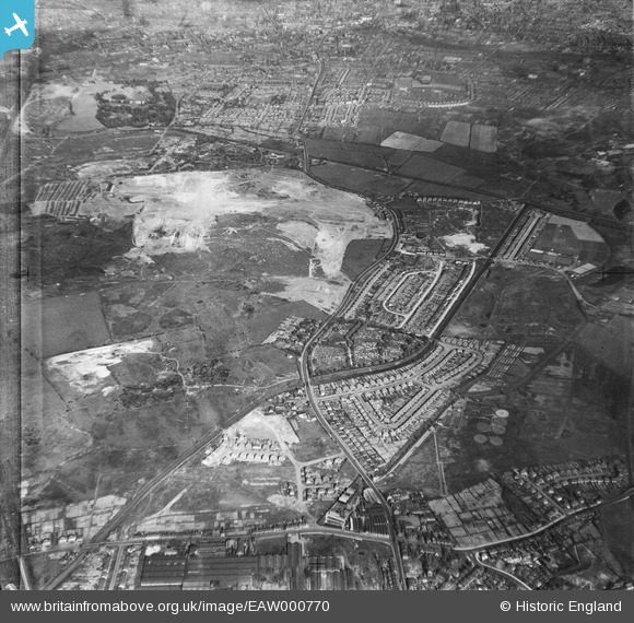
EAW000770 ENGLAND (1946). Industrial land adjacent to Wolverhampton Road and Bentley Cemetery, Bentley 1946
© Hawlfraint cyfranwyr OpenStreetMap a thrwyddedwyd gan yr OpenStreetMap Foundation. 2026. Trwyddedir y gartograffeg fel CC BY-SA.
Delweddau cyfagos (9)
EAW000770

 0°
0m
0°
0m
EAW000776
 23°
158m
23°
158m
EAW000773
 292°
161m
292°
161m
EAW000772
 352°
170m
352°
170m
EAW047011
 219°
182m
219°
182m
EAW047013
 61°
201m
61°
201m
EAW000779
 156°
243m
156°
243m
EAW047015
 223°
244m
223°
244m
EAW000771
 323°
293m
323°
293m
Manylion
| Pennawd | [EAW000770] Industrial land adjacent to Wolverhampton Road and Bentley Cemetery, Bentley 1946 |
| Cyfeirnod | EAW000770 |
| Dyddiad | 11-May-1946 |
| Dolen | |
| Enw lle | BENTLEY |
| Plwyf | |
| Ardal | |
| Gwlad | ENGLAND |
| Dwyreiniad / Gogleddiad | 398283, 298793 |
| Hydred / Lledred | -2.025345747939, 52.586582634923 |
| Cyfeirnod Grid Cenedlaethol | SO983988 |
Pinnau
 Flour Mill. Originally Albion flour mill, now known as Smith Flour Mill and has been converted into flats.
http://blackcountryhistory.org/collections/getrecord/WAHER_MBL1813/ Flour Mill. Originally Albion flour mill, now known as Smith Flour Mill and has been converted into flats.
http://blackcountryhistory.org/collections/getrecord/WAHER_MBL1813/ |

PaulEdwards |
Tuesday 7th of July 2015 11:43:17 PM |
| Noahs Ark pub.
EDIT: This is approximately the position of the pub now. However, after speaking with an old local (my Dad), the original Noahs Ark would be somewhere behind the houses to the left of this marker. |
PaulEdwards |
Sunday 28th of June 2015 10:37:16 PM |
| Site of the Red Lion (Recently refurbished into a "Hungry Horse") |
PaulEdwards |
Tuesday 16th of June 2015 10:21:31 AM |
| This gap between the houses became Overdale Drive. |
PaulEdwards |
Tuesday 16th of June 2015 10:18:06 AM |
| The Alma Inn |
PaulEdwards |
Monday 15th of June 2015 11:04:47 AM |
| Bentley Mill Way |
PaulEdwards |
Monday 15th of June 2015 10:30:11 AM |
| St. Mathews Church |
PaulEdwards |
Sunday 14th of June 2015 05:01:49 PM |
| The Belle Vue pub |
PaulEdwards |
Sunday 14th of June 2015 04:51:35 PM |
| Future site of Walsall B (Birchills) Power station.
Also, the first Walsall power station was in this area, although present at the time of this photo (Work on the first station started in 1914, operational by 1916 but not declared open until 1922)it cannot be distinguished in this photo to the best of my knowledge) |
PaulEdwards |
Sunday 14th of June 2015 10:38:10 AM |
| Reedswood park |
PaulEdwards |
Thursday 11th of June 2015 09:53:22 AM |
| Approximate site of Bentley Cairne |
PaulEdwards |
Saturday 6th of June 2015 10:55:37 PM |
| Lane Arms pub, now demolished after being damaged by fire. |
PaulEdwards |
Saturday 6th of June 2015 10:51:54 PM |
| Bentley Mill Lane |
PaulEdwards |
Saturday 6th of June 2015 10:50:30 PM |
| Bentley Road North |
PaulEdwards |
Saturday 6th of June 2015 10:48:13 PM |
| Robin Hood pub. |
Bentleyboy |
Saturday 5th of April 2014 08:32:49 AM |
| 'Board Schools'. site of today's Sikh temple. |
Bentleyboy |
Saturday 5th of April 2014 08:30:41 AM |
| Rubery Owens sports ground. |
Bentleyboy |
Saturday 5th of April 2014 08:28:55 AM |
| approximate site of M6 junction 10 |
Martin |
Friday 31st of January 2014 07:07:25 PM |
| Hopyard brick works |
Martin |
Friday 31st of January 2014 07:03:16 PM |
| Bentley Canal Birmingham Canal Navigations |
Martin |
Thursday 26th of December 2013 02:20:16 PM |
Cyfraniadau Grŵp
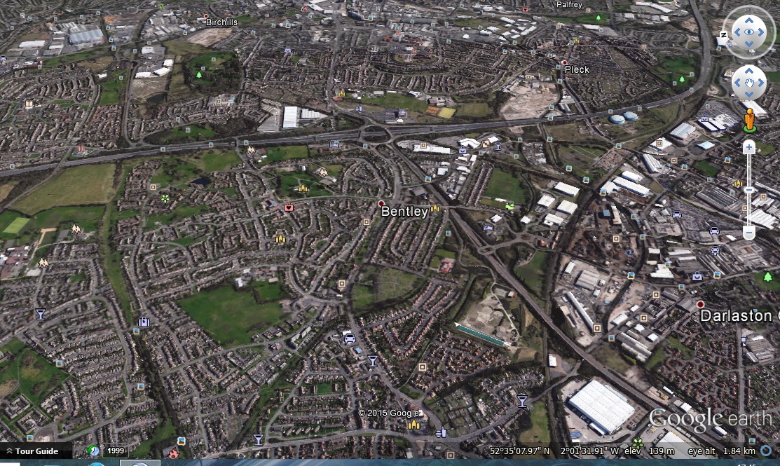
A Google Earth image from approximately the same location as the original was taken. |
PaulEdwards |
Monday 8th of June 2015 05:47:49 PM |