
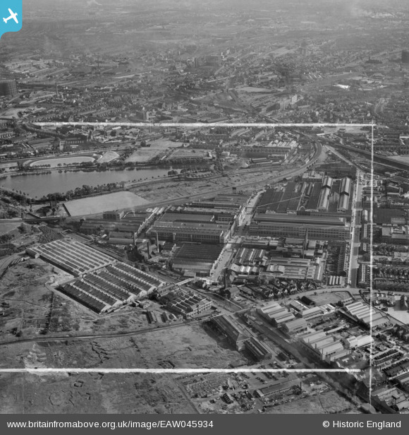
EAW045934 ENGLAND (1952). The General Electric Co Ltd Witton Works and environs, Witton, from the north, 1952. This image was marked by Aerofilms Ltd for photo editing.
© Hawlfraint cyfranwyr OpenStreetMap a thrwyddedwyd gan yr OpenStreetMap Foundation. 2026. Trwyddedir y gartograffeg fel CC BY-SA.
Delweddau cyfagos (15)
EAW045934

EPW028856

EPW028861

EPW028862

EPW028857

EPW028859

EPW009731

EPW028860

EPW005708

EPW028858

EPW005709

EAW045935

EPW001093

EPW031382

EPW031384

Manylion
| Pennawd | [EAW045934] The General Electric Co Ltd Witton Works and environs, Witton, from the north, 1952. This image was marked by Aerofilms Ltd for photo editing. |
| Cyfeirnod | EAW045934 |
| Dyddiad | 14-August-1952 |
| Dolen | |
| Enw lle | WITTON |
| Plwyf | |
| Ardal | |
| Gwlad | ENGLAND |
| Dwyreiniad / Gogleddiad | 408845, 290645 |
| Hydred / Lledred | -1.8696506434005, 52.513255704537 |
| Cyfeirnod Grid Cenedlaethol | SP088906 |
