
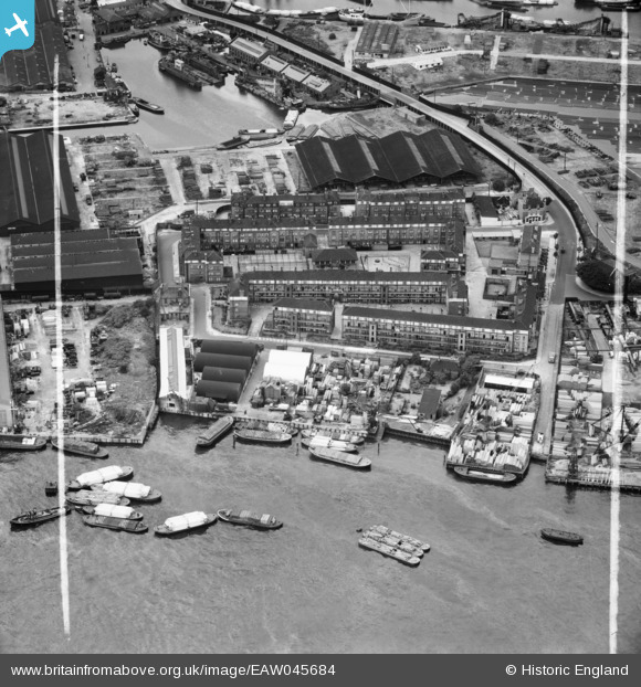
EAW045684 ENGLAND (1952). The Odessa and Redriff Wharves and the Redriff Estate, Rotherhithe, 1952. This image was marked by Aerofilms Ltd for photo editing.
© Hawlfraint cyfranwyr OpenStreetMap a thrwyddedwyd gan yr OpenStreetMap Foundation. 2026. Trwyddedir y gartograffeg fel CC BY-SA.
Delweddau cyfagos (9)
EAW045684

EAW045681

EAW045682

EAW045687

EAW045686

EAW045683

EAW045685

EAW045688

EPR000220

Manylion
| Pennawd | [EAW045684] The Odessa and Redriff Wharves and the Redriff Estate, Rotherhithe, 1952. This image was marked by Aerofilms Ltd for photo editing. |
| Cyfeirnod | EAW045684 |
| Dyddiad | 31-July-1952 |
| Dolen | |
| Enw lle | ROTHERHITHE |
| Plwyf | |
| Ardal | |
| Gwlad | ENGLAND |
| Dwyreiniad / Gogleddiad | 536567, 179443 |
| Hydred / Lledred | -0.032393855620359, 51.496925252357 |
| Cyfeirnod Grid Cenedlaethol | TQ366794 |
Pinnau
Byddwch y cyntaf i ychwanegu sylw at y ddelwedd hon!