
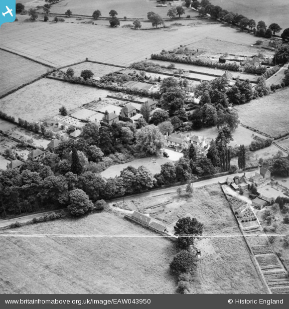
EAW043950 ENGLAND (1952). White House Preparatory School and the surrounding area, Eastheath, 1952. This image was marked by Aerofilms Ltd for photo editing.
© Hawlfraint cyfranwyr OpenStreetMap a thrwyddedwyd gan yr OpenStreetMap Foundation. 2026. Trwyddedir y gartograffeg fel CC BY-SA.
Delweddau cyfagos (7)
EAW043950

EAW043948

EAW043952

EAW043949

EAW043953

EAW043951

EAW043954

Manylion
| Pennawd | [EAW043950] White House Preparatory School and the surrounding area, Eastheath, 1952. This image was marked by Aerofilms Ltd for photo editing. |
| Cyfeirnod | EAW043950 |
| Dyddiad | 10-June-1952 |
| Dolen | |
| Enw lle | EASTHEATH |
| Plwyf | WOKINGHAM |
| Ardal | |
| Gwlad | ENGLAND |
| Dwyreiniad / Gogleddiad | 480486, 167046 |
| Hydred / Lledred | -0.84296903101118, 51.396237832674 |
| Cyfeirnod Grid Cenedlaethol | SU805670 |
Pinnau

Vauni |
Tuesday 22nd of July 2014 03:19:13 PM |