
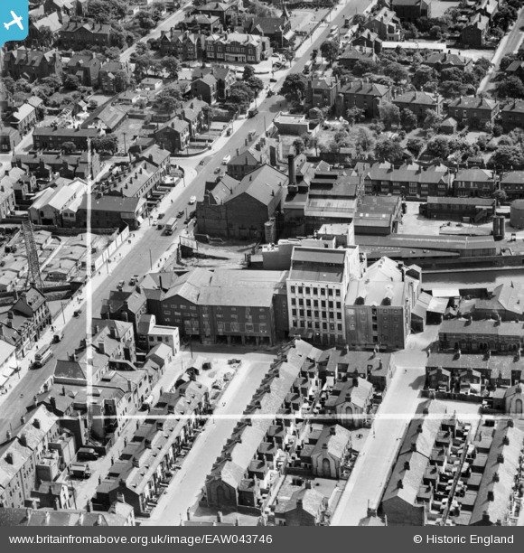
EAW043746 ENGLAND (1952). Appleby Flour Mill beside the Leeds and Liverpool Canal, Bootle, 1952. This image was marked by Aerofilms Ltd for photo editing.
© Hawlfraint cyfranwyr OpenStreetMap a thrwyddedwyd gan yr OpenStreetMap Foundation. 2026. Trwyddedir y gartograffeg fel CC BY-SA.
Delweddau cyfagos (10)
EAW043746

EAW043743

EAW043741

EAW043740

EAW043744

EAW043742

EAW043745

EAW043739

EAW043747

EAW039584

Manylion
| Pennawd | [EAW043746] Appleby Flour Mill beside the Leeds and Liverpool Canal, Bootle, 1952. This image was marked by Aerofilms Ltd for photo editing. |
| Cyfeirnod | EAW043746 |
| Dyddiad | 5-June-1952 |
| Dolen | |
| Enw lle | BOOTLE |
| Plwyf | |
| Ardal | |
| Gwlad | ENGLAND |
| Dwyreiniad / Gogleddiad | 334288, 395338 |
| Hydred / Lledred | -2.9896016625695, 53.450444584888 |
| Cyfeirnod Grid Cenedlaethol | SJ343953 |
Pinnau

giropay |
Sunday 22nd of August 2021 11:35:20 PM |