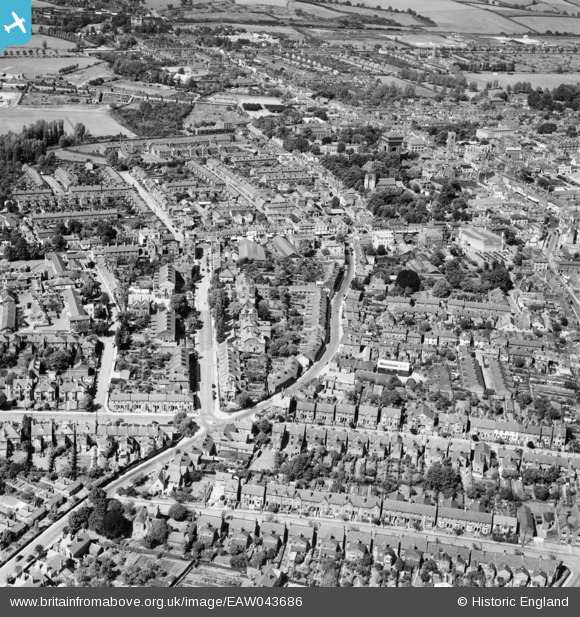
EAW043686 ENGLAND (1952). Maldon Road and the surrounding town, Colchester, 1952
© Hawlfraint cyfranwyr OpenStreetMap a thrwyddedwyd gan yr OpenStreetMap Foundation. 2026. Trwyddedir y gartograffeg fel CC BY-SA.
Delweddau cyfagos (5)
Manylion
| Pennawd | [EAW043686] Maldon Road and the surrounding town, Colchester, 1952 |
| Cyfeirnod | EAW043686 |
| Dyddiad | 4-June-1952 |
| Dolen | |
| Enw lle | COLCHESTER |
| Plwyf | |
| Ardal | |
| Gwlad | ENGLAND |
| Dwyreiniad / Gogleddiad | 599118, 224863 |
| Hydred / Lledred | 0.89370179550184, 51.886268360731 |
| Cyfeirnod Grid Cenedlaethol | TL991249 |
Pinnau

woodsy007 |
Sunday 27th of July 2014 10:34:27 PM | |

woodsy007 |
Sunday 27th of July 2014 10:33:54 PM | |

woodsy007 |
Sunday 27th of July 2014 10:33:14 PM | |

woodsy007 |
Sunday 27th of July 2014 10:29:10 PM | |

woodsy007 |
Sunday 27th of July 2014 10:26:16 PM | |

woodsy007 |
Sunday 27th of July 2014 10:24:06 PM | |

woodsy007 |
Sunday 27th of July 2014 10:23:15 PM | |

woodsy007 |
Sunday 27th of July 2014 10:21:53 PM | |

woodsy007 |
Sunday 27th of July 2014 10:20:22 PM | |

woodsy007 |
Sunday 27th of July 2014 10:19:11 PM | |

woodsy007 |
Sunday 27th of July 2014 10:16:58 PM | |

woodsy007 |
Sunday 27th of July 2014 10:15:36 PM | |

woodsy007 |
Sunday 27th of July 2014 10:14:56 PM |


![[EAW043686] Maldon Road and the surrounding town, Colchester, 1952](http://britainfromabove.org.uk/sites/all/libraries/aerofilms-images/public/100x100/EAW/043/EAW043686.jpg)
![[EPW001856] View of Colchester, the Water Tower and Crouch Street area, Colchester, 1920](http://britainfromabove.org.uk/sites/all/libraries/aerofilms-images/public/100x100/EPW/001/EPW001856.jpg)
![[EAW014001] The town, Colchester, from the south, 1948](http://britainfromabove.org.uk/sites/all/libraries/aerofilms-images/public/100x100/EAW/014/EAW014001.jpg)
![[EPW001855] View of Colchester and Le Cateau Barracks, Colchester, 1920](http://britainfromabove.org.uk/sites/all/libraries/aerofilms-images/public/100x100/EPW/001/EPW001855.jpg)
![[EAW037256] Head Street, North Hill and the town, Colchester, 1951. This image has been produced from a print.](http://britainfromabove.org.uk/sites/all/libraries/aerofilms-images/public/100x100/EAW/037/EAW037256.jpg)