
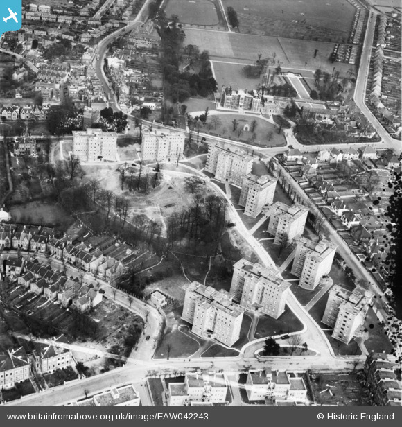
EAW042243 ENGLAND (1952). The Springfield Housing Estate, Charlton, 1952. This image was marked by Aerofilms Ltd for photo editing.
© Hawlfraint cyfranwyr OpenStreetMap a thrwyddedwyd gan yr OpenStreetMap Foundation. 2026. Trwyddedir y gartograffeg fel CC BY-SA.
Delweddau cyfagos (14)
EAW042243

EAW042241

EAW042250

EAW042248

EAW042242

EAW042247

EAW042245

EAW042246

EAW042244

EAW042249

EAW005424

EAW005426

EAW005423

EAW005427

Manylion
| Pennawd | [EAW042243] The Springfield Housing Estate, Charlton, 1952. This image was marked by Aerofilms Ltd for photo editing. |
| Cyfeirnod | EAW042243 |
| Dyddiad | 7-April-1952 |
| Dolen | |
| Enw lle | CHARLTON |
| Plwyf | |
| Ardal | |
| Gwlad | ENGLAND |
| Dwyreiniad / Gogleddiad | 541368, 177733 |
| Hydred / Lledred | 0.036046081804395, 51.480377366508 |
| Cyfeirnod Grid Cenedlaethol | TQ414777 |
