
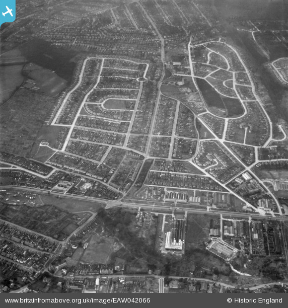
EAW042066 ENGLAND (1952). Housing estates at Poverest, Orpington, 1952
© Hawlfraint cyfranwyr OpenStreetMap a thrwyddedwyd gan yr OpenStreetMap Foundation. 2026. Trwyddedir y gartograffeg fel CC BY-SA.
Delweddau cyfagos (3)
EAW042066

EAW042072
, Orpington, 1952. This image has been produced from a damaged negative.")
EAW042068

Manylion
| Pennawd | [EAW042066] Housing estates at Poverest, Orpington, 1952 |
| Cyfeirnod | EAW042066 |
| Dyddiad | March-1952 |
| Dolen | |
| Enw lle | ORPINGTON |
| Plwyf | |
| Ardal | |
| Gwlad | ENGLAND |
| Dwyreiniad / Gogleddiad | 546563, 167663 |
| Hydred / Lledred | 0.10664499277268, 51.388560784556 |
| Cyfeirnod Grid Cenedlaethol | TQ466677 |
Pinnau

Buzby9 |
Thursday 24th of July 2014 08:21:49 PM | |
|
Mike Floate |
Friday 25th of April 2014 05:33:14 PM |
